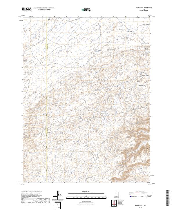
2023 Map of Crow Knoll
USGS Topo · Published 2023About this map
Uinta Basin terrain dominates this 2023 survey along the border of Duchesne and Uintah counties. The landscape is defined by a series of arid drainage systems and distinct geographic markers such as Crow Knoll and the Sheep Knolls. These features, along with Flu Knolls and Antelope Knolls, provide vertical relief across the expansive Eightmile Flat and the area known as the Little Desert. Transport through this remote section of Utah is limited to a network of unpaved routes, including Eight Mile Flat Rd, Big Wash Rd, and Felter Ranch Rd. The map illustrates the intricate drainage patterns of the high desert, where seasonal waterways like Big Wash, Petes Wash, and Desert Spring Wash have carved through the basin floor. This modern record is an essential tool for understanding the topography of the region's ranching lands and natural basins.
Find a feature on this map
19 named features on this map. Tap any name to fly to it.
Don’t see what you’re looking for? This feature index may not catch every label — zoom into the map to look around manually.
Map Details
Editions of this 2023 Crow Knoll Map
This is the sole edition of this map. No revisions or reprints were ever made.
Other maps of this area

1885 · East Tavaputs
USGS Topo · 1:250,000

1885 · Ashley
USGS Topo · 1:250,000

1885 · Uinta
USGS Topo · 1:250,000

1886 · Price River
USGS Topo · 1:250,000

1896 · Price River
USGS Topo · 1:250,000

1917 · Vernal
USGS Topo · 1:125,000

1939 · Duchesne
USGS Topo · 1:125,000

1953 · Nutters Hole
USGS Topo · 1:62,500

1954 · Salt Lake City
USGS Topo · 1:250,000

1954 · Vernal
USGS Topo · 1:250,000