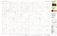
1982 Map of Crow Lake
USGS Topo · Published 1983About this map
Crow Lake State Game Production Area and the neighboring Horseshoe Lake State Game Production Area anchor this agricultural landscape along the boundary of Jerauld and Aurora counties. The area is defined by its wide depressions and glacial features, including the eponymous Crow Lake and smaller bodies like Hoagland Lake. The settlement pattern is typical of the Great Plains, where small civic and religious institutions serve a dispersed farming population.
Find a feature on this map
27 named features on this map. Tap any name to fly to it.
Don’t see what you’re looking for? This feature index may not catch every label — zoom into the map to look around manually.
Map Details
Editions of this 1982 Crow Lake Map
This is the sole edition of this map. No revisions or reprints were ever made.
Other maps of this area

1898 · Huron
USGS Topo · 1:125,000

1899 · Mitchell
USGS Topo · 1:125,000

1941 · Kimball North
USGS Topo · 1:62,500

1942 · Crow Lake
USGS Topo · 1:62,500

1951 · Kimball North
USGS Topo · 1:62,500

1953 · Huron
USGS Topo · 1:250,000

1954 · Huron
USGS Topo · 1:250,000

1955 · Mitchell
USGS Topo · 1:250,000

1959 · Mitchell
USGS Topo · 1:250,000

1973 · Wessington Springs
USGS Topo · 1:24,000
Featured Places
- Crow Lake, SD
- Anina Township, SD
- Pleasant Valley Township, SD
- Bristol Township, SD
- Crow Lake Township, SD