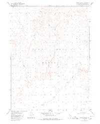
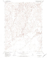
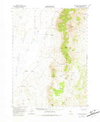
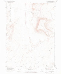
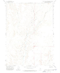
1979 Map of Crowbar Spring
USGS Topo · Published 1980About this map
Black Rock Desert defines this portion of Humboldt County, appearing in the late 1970s as a stark expanse of alkaline flats and ephemeral drainages. The landscape is shaped by the seasonal movement of water, most notably where the Quinn River meanders across the southern portion of the quadrangle. This arid basin is fed by intermittent streams including Battle Creek and Indian Creek, which descend from the surrounding high ground toward the desert floor. Near the northwestern corner, Crowbar Spring provides a critical perennial water source in an otherwise parched environment. The map captures a moment in the modern era of the Great Basin, where the land is largely defined by its natural hydrology and the expansive reach of the Paiute terrain, reflecting the enduring character of this remote Nevada wilderness before later 20th-century developments.
Find a feature on this map
6 named features on this map. Tap any name to fly to it.
Don’t see what you’re looking for? This feature index may not catch every label — zoom into the map to look around manually.
Map Details
Editions of this 1979 Crowbar Spring Map
2 editions found
Other maps of this area

1886 · Disaster
USGS Topo · 1:250,000

1893 · Disaster
USGS Topo · 1:250,000

1954 · Vya
USGS Topo · 1:250,000

1958 · Vya
USGS Topo · 1:250,000

1962 · Vya
USGS Topo · 1:250,000
1966 · King Lear Peak
USGS Topo · 1:62,500
1972 · Pinto Mountain
USGS Topo · 1:24,000
1972 · Leonard Cr. Slough South
USGS Topo · 1:24,000
1972 · Paiute Meadows
USGS Topo · 1:24,000
1979 · Pidgeon Spring
USGS Topo · 1:24,000