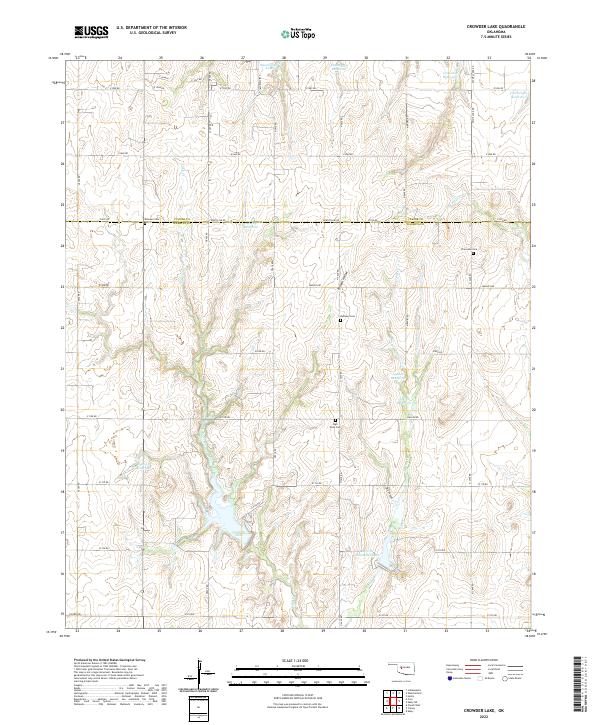
2022 Map of Crowder Lake
USGS Topo · Published 2022About this map
Crowder Lake serves as a central geographic focus on the border of Custer and Washita Counties, where the landscape is defined by a series of north-south drainages and man-made impoundments. The terrain is notably dissected by Cobb Creek and Spring Creek, creating a rugged topography of ridges and draws such as Possum Hollow and Dry Canyon. This agricultural and ranching landscape is organized by a strict section-line road grid, including Countyline Road and N 2400 Road, which connects various rural homesteads and landmarks.
Find a feature on this map
50 named features on this map. Tap any name to fly to it.
Don’t see what you’re looking for? This feature index may not catch every label — zoom into the map to look around manually.
Map Details
Editions of this 2022 Crowder Lake Map
This is the sole edition of this map. No revisions or reprints were ever made.
Other maps of this area

1955 · Clinton
USGS Topo · 1:250,000

1956 · Cordell
USGS Topo · 1:62,500

1957 · Clinton
USGS Topo · 1:250,000

1957 · Clinton
USGS Topo · 1:62,500

1961 · Eakly
USGS Topo · 1:62,500

1964 · Weatherford
USGS Topo · 1:62,500

1976 · Clinton SE
USGS Topo · 1:24,000
1983 · Corn
USGS Topo · 1:24,000
1983 · Indianapolis
USGS Topo · 1:24,000

1983 · Cloud Chief
USGS Topo · 1:24,000