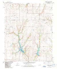
1985 Map of Crowder Lake
USGS Topo · Published 1985About this map
Crowder Lake State Recreation Area and the waters of Crowder Lake define the central landscape of this western Oklahoma survey. The terrain is marked by an extensive network of energy infrastructure, with numerous Gas Wells and Drill Holes scattered across the plains of Custer and Washita Counties. Local history is anchored by several rural cemeteries, including Missouri Cem, Plainview Cem, Bethany Cem, and High Point Cem, which serve as lasting markers of early settlement patterns in the Texas and Seger townships.
Find a feature on this map
28 named features on this map. Tap any name to fly to it.
Don’t see what you’re looking for? This feature index may not catch every label — zoom into the map to look around manually.
Map Details
Editions of this 1985 Crowder Lake Map
This is the sole edition of this map. No revisions or reprints were ever made.
Other maps of this area

1955 · Clinton
USGS Topo · 1:250,000

1956 · Cordell
USGS Topo · 1:62,500

1957 · Clinton
USGS Topo · 1:250,000

1957 · Clinton
USGS Topo · 1:62,500

1961 · Eakly
USGS Topo · 1:62,500

1964 · Weatherford
USGS Topo · 1:62,500

1976 · Clinton SE
USGS Topo · 1:24,000
1983 · Corn
USGS Topo · 1:24,000
1983 · Indianapolis
USGS Topo · 1:24,000

1983 · Cloud Chief
USGS Topo · 1:24,000