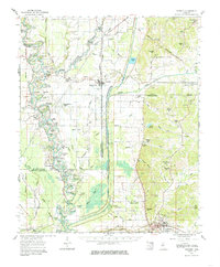
1962 Map of Crowder
USGS Topo · Published 1985About this map
The Illinois Central Railroad corridor anchors this 1962 Mississippi Delta survey, running north-south through the village of Crowder and down toward Charleston. The landscape is a complex network of seasonal water and flood control, dominated by the Tallahatchie River and its numerous oxbow formations such as Horseshoe Lake, Oxbow Lake, and Yonkapin Lake. This era shows a rural society defined by its community landmarks, with dozens of small churches and cemeteries like Shady Grove Ch, Tocowa Ch, and St Johns Cem dotting the plantation lands and creek bottoms. The Choctaw Chickasaw Boundary Line cuts diagonally across the northeastern quadrant, marking an old tribal and land-survey division that persists in the county borders of Quitman, Tallahatchie, and Panola. Small educational sites, including the Wright School and Sherman Creek Sch, serve the scattered settlements of Mims, Rayburn, and Sherman.
Find a feature on this map
94 named features on this map. Tap any name to fly to it.
Don’t see what you’re looking for? This feature index may not catch every label — zoom into the map to look around manually.
Map Details
Editions of this 1962 Crowder Map
3 editions found
Other maps of this area

1931 · Sumner
USGS Topo · 1:48,000

1932 · Sledge
USGS Topo · 1:48,000

1932 · Philipp
USGS Topo · 1:48,000

1932 · Tutwiler
USGS Topo · 1:48,000

1932 · Marks
USGS Topo · 1:48,000

1935 · Crowder
USGS Topo · 1:62,500

1935 · Marks
USGS Topo · 1:62,500

1935 · Sumner
USGS Topo · 1:62,500

1935 · Tutwiler
USGS Topo · 1:62,500

1935 · Sledge
USGS Topo · 1:62,500