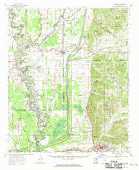
1962 Map of Crowder
USGS Topo · Published 1970About this map
The Choctaw Chickasaw Boundary Line cuts diagonally across this Delta landscape, a surveyor's mark of history that persists alongside the complex hydrology of the Tallahatchie River and Yocona River. The early 1960s environment is defined by an intricate network of oxbows and cypress brakes, including Duck Roost Lake, Croudip Lake, and Burnt Brake. This web of water is managed by the massive Panola Quitman Floodway, which runs straight through the terrain south of Crowder.
Find a feature on this map
92 named features on this map. Tap any name to fly to it.
Don’t see what you’re looking for? This feature index may not catch every label — zoom into the map to look around manually.
Map Details
Editions of this 1962 Crowder Map
3 editions found
Other maps of this area

1931 · Sumner
USGS Topo · 1:48,000

1932 · Sledge
USGS Topo · 1:48,000

1932 · Philipp
USGS Topo · 1:48,000

1932 · Tutwiler
USGS Topo · 1:48,000

1932 · Marks
USGS Topo · 1:48,000

1935 · Crowder
USGS Topo · 1:62,500

1935 · Marks
USGS Topo · 1:62,500

1935 · Sumner
USGS Topo · 1:62,500

1935 · Tutwiler
USGS Topo · 1:62,500

1935 · Sledge
USGS Topo · 1:62,500