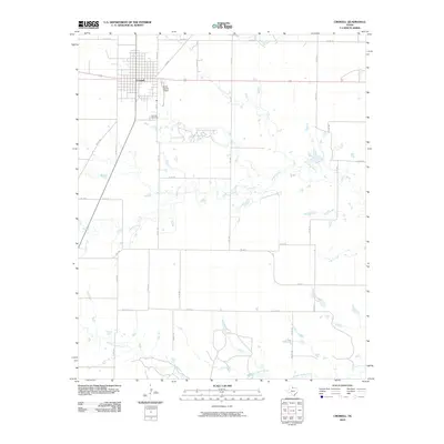
2010 Map of Crowell
USGS Topo · Published 2010About this map
Crowell, the county seat of Foard County, dominates the northwestern portion of this 2010 survey, showing a well-organized grid system intersected by Highway 70 and FM 98. The town’s surrounding landscape is a testament to the rural Texas ranching and farming economy, where numerous stock tanks and intermittent watercourses like Mule Creek define the drainage patterns. Genealogy researchers will find the Crowell Cemetery just south of the main town center, while transportation infrastructure is anchored by the Foard County Airport. The southern reaches of the map are defined by the winding paths of Beaver Creek and Middle Beaver Creek, which create complex seasonal drainage networks across the plains. A dense network of farm-to-market and county roads, such as FM 1594 and FM 2877, provides access to the expansive agricultural holdings that surround the central settlement.
Find a feature on this map
34 named features on this map. Tap any name to fly to it.
Don’t see what you’re looking for? This feature index may not catch every label — zoom into the map to look around manually.
Map Details
Editions of this 2010 Crowell Map
This is the sole edition of this map. No revisions or reprints were ever made.
Other maps of this area

1932 · Vivian
USGS Topo · 1:62,500

1954 · Wichita Falls
USGS Topo · 1:250,000

1955 · Lawton
USGS Topo · 1:250,000

1958 · Wichita Falls
USGS Topo · 1:250,000

1958 · Medicine Mound
USGS Topo · 1:62,500

1960 · Teacup Mountain
USGS Topo · 1:62,500

1966 · Truscott North
USGS Topo · 1:24,000

1966 · Colwell Creek
USGS Topo · 1:24,000

1966 · Halsell Ranch
USGS Topo · 1:24,000

1966 · Crowell
USGS Topo · 1:24,000