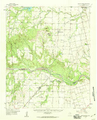
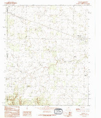
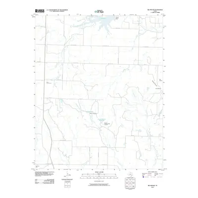
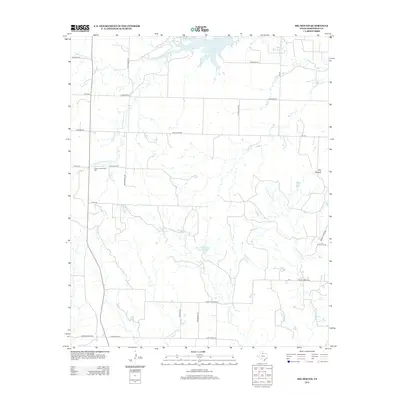
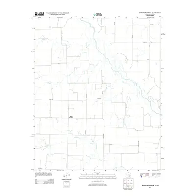
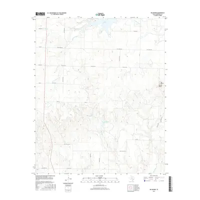
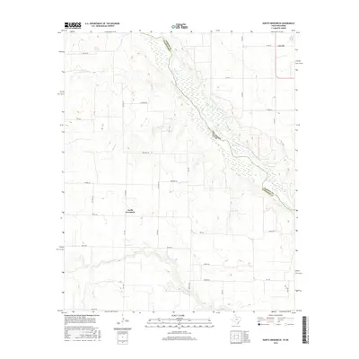
1958 Map of Medicine Mound
USGS Topo · Published 1959About this map
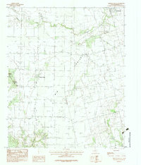
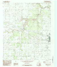
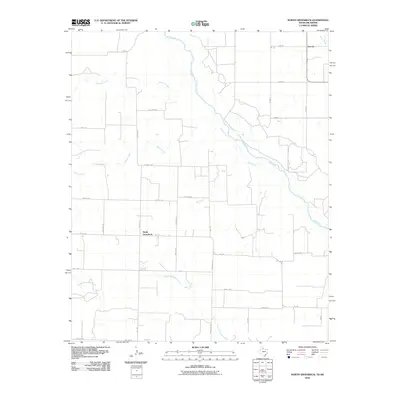
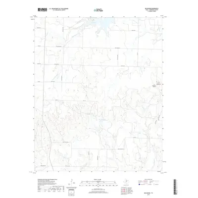
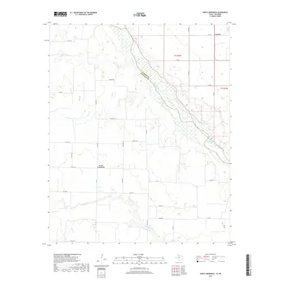
The Medicine Mounds, a series of distinct rises including Big Mound and Little Mound, dominate the central Texas landscape along the Hardeman and Foard County line. This 1958 survey captures the region's historical depth through specific commemorative sites, such as the Historical Marker (Pease River Battlefield) south of the Pease River and another noting the Original Townsite of Margaret. The settlement pattern follows the Panhandle and Santa Fe railroad through Chillicothe and down to the rural community of Margaret. Agricultural life is anchored by local institutions like Prairie View Ch and several family or community burial grounds including Big Valley Cem and Thalia Cem. Water management is evident through the Crowell Water Supply and the engineered expanse of Lake Pauline on Wanderers Creek in the northwest.
Find a feature on this map
33 named features on this map. Tap any name to fly to it.
Don’t see what you’re looking for? This feature index may not catch every label — zoom into the map to look around manually.
Map Details
Editions of this 1958 Medicine Mound Map
This is the sole edition of this map. No revisions or reprints were ever made.
Historical Maps of Chillicothe Through Time
57 maps found
1927 Quanah 3-a
Hardeman County, TX
1958 Medicine Mound
Hardeman County, TX
1960 Goodlett
Hardeman County, TX
1983 Big Mound
Hardeman County, TX
1983 Medicine Mound
Hardeman County, TX
1984 Goodlett
Hardeman County, TX
1984 Maybell Canyon
Hardeman County, TX
1984 Quanah East
Hardeman County, TX
1984 Quanah West
Hardeman County, TX
1984 Willams
Hardeman County, TX
1985 North Groesbeck
Hardeman County, TX
1990 Big Mound
Hardeman County, TX
1990 Goodlett
Hardeman County, TX
1990 Maybell Canyon
Hardeman County, TX
1990 Medicine Mound
Hardeman County, TX

1990 Quanah West
Hardeman County, TX
1990 Willams
Hardeman County, TX
2010 Big Mound
Hardeman County, TX
2010 Goodlett
Hardeman County, TX
2010 Maybell Canyon
Hardeman County, TX
2010 Medicine Mound
Hardeman County, TX
2010 North Groesbeck
Hardeman County, TX
2010 Quanah East
Hardeman County, TX
2010 Quanah West
Hardeman County, TX
2010 Williams
Hardeman County, TX
2012 Big Mound
Hardeman County, TX
2012 Goodlett
Hardeman County, TX
2012 Maybell Canyon
Hardeman County, TX
2012 Medicine Mound
Hardeman County, TX
2012 North Groesbeck
Hardeman County, TX
2012 Quanah East
Hardeman County, TX
2012 Quanah West
Hardeman County, TX
2012 Williams
Hardeman County, TX
2016 Big Mound
Hardeman County, TX
2016 Goodlett
Hardeman County, TX
2016 Maybell Canyon
Hardeman County, TX
2016 Medicine Mound
Hardeman County, TX
2016 North Groesbeck
Hardeman County, TX
2016 Quanah East
Hardeman County, TX
2016 Quanah West
Hardeman County, TX
2016 Williams
Hardeman County, TX
2019 Big Mound
Hardeman County, TX
2019 Goodlett
Hardeman County, TX
2019 Maybell Canyon
Hardeman County, TX
2019 Medicine Mound
Hardeman County, TX
2019 North Groesbeck
Hardeman County, TX
2019 Quanah East
Hardeman County, TX
2019 Quanah West
Hardeman County, TX
2019 Williams
Hardeman County, TX
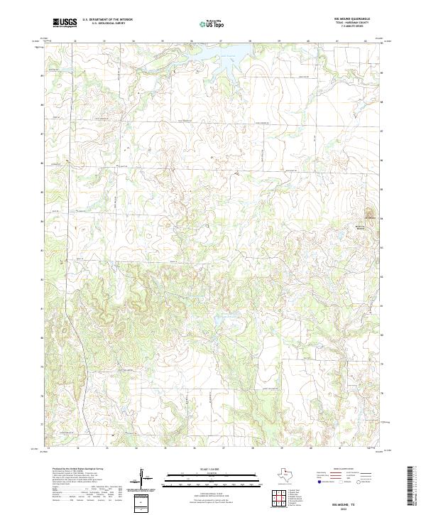
2022 Big Mound
Hardeman County, TX
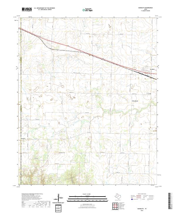
2022 Goodlett
Hardeman County, TX
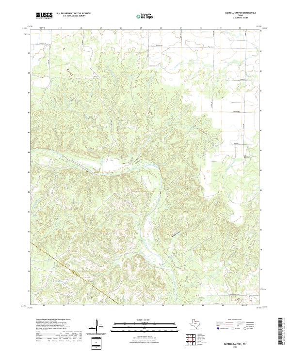
2022 Maybell Canyon
Hardeman County, TX
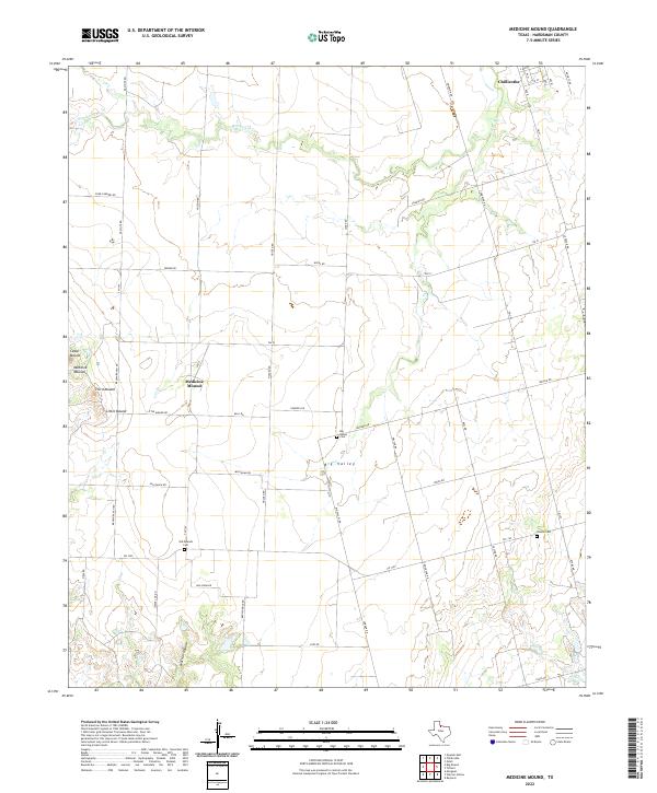
2022 Medicine Mound
Hardeman County, TX
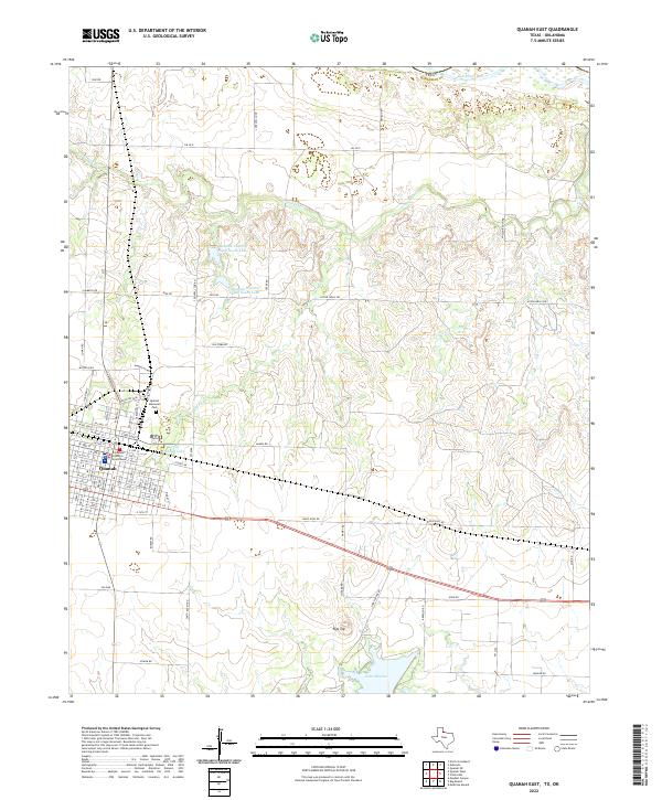
2022 Quanah East
Hardeman County, TX
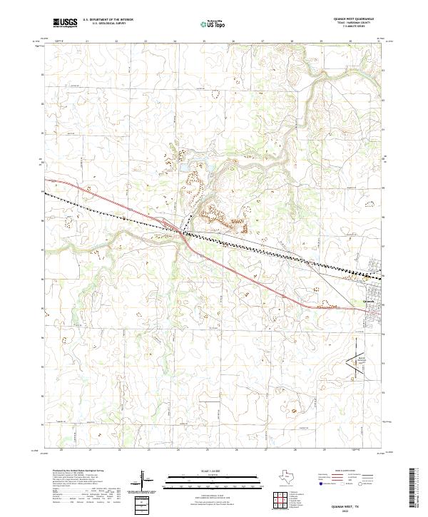
2022 Quanah West
Hardeman County, TX
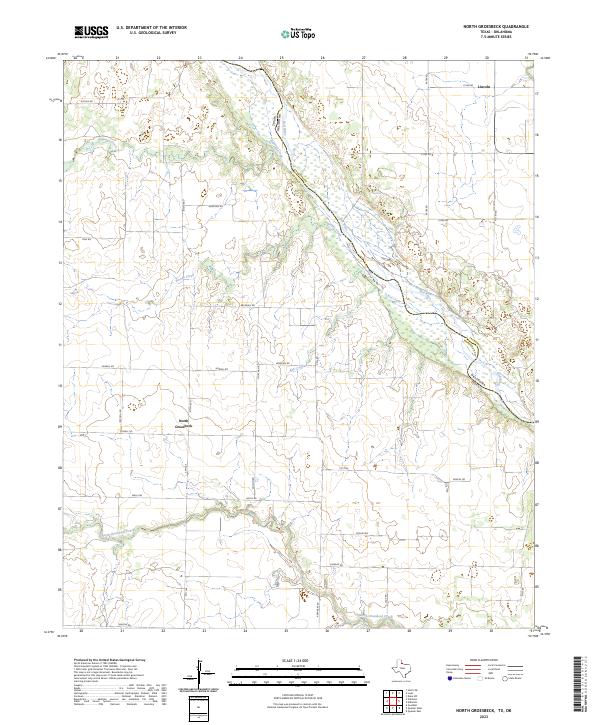
2023 North Groesbeck
Hardeman County, TX
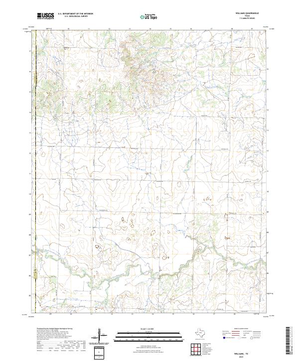
2023 Williams
Hardeman County, TX