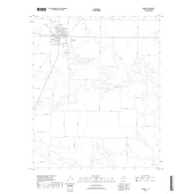
2019 Map of Crowell
USGS Topo · Published 2019About this map
The city of Crowell serves as the focal point of this Foard County landscape, revealing a structured grid of residential and commercial streets. Significant local identifiers include the Crowell Cem located south of the main town center and the Foard County Airport to the east. The terrain is defined by the drainage patterns of several tributaries, including Beaver Cr, Middle Beaver Cr, and Mule Cr, which snake through the surrounding ranch and farmland. The road network, characterized by numerous county routes like Co RD 213 and Co RD 314, illustrates the connectivity between the rural homesteads and the county seat. This survey provides a clear view of the intersection of traditional West Texas ranching land with modernized infrastructure in the late 2010s.
Find a feature on this map
58 named features on this map. Tap any name to fly to it.
Don’t see what you’re looking for? This feature index may not catch every label — zoom into the map to look around manually.
Map Details
Editions of this 2019 Crowell Map
This is the sole edition of this map. No revisions or reprints were ever made.
Other maps of this area

1932 · Vivian
USGS Topo · 1:62,500

1954 · Wichita Falls
USGS Topo · 1:250,000

1955 · Lawton
USGS Topo · 1:250,000

1958 · Wichita Falls
USGS Topo · 1:250,000

1958 · Medicine Mound
USGS Topo · 1:62,500

1960 · Teacup Mountain
USGS Topo · 1:62,500

1966 · Truscott North
USGS Topo · 1:24,000

1966 · Colwell Creek
USGS Topo · 1:24,000

1966 · Halsell Ranch
USGS Topo · 1:24,000

1966 · Crowell
USGS Topo · 1:24,000