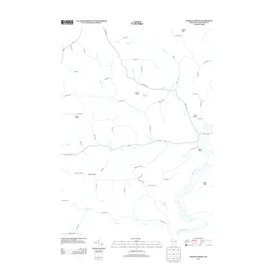
2013 Map of Crowley Ridge
USGS Topo · Published 2013About this map
Crowley Ridge and its surrounding heights define this portion of the Wisconsin Driftless Area, where a complex network of ridges and hollows dictates the local geography. The winding Kickapoo River flows through the southeastern portion of the map, creating a distinct floodplain that contrasts with the elevated terrain of Niland Ridge and Pleasant Ridge. This topography has historically shaped the settlement and transportation patterns of the region, with roads often following the crests of ridges like Shanghai Ridge or the floor of sheltered valleys.
Find a feature on this map
51 named features on this map. Tap any name to fly to it.
Don’t see what you’re looking for? This feature index may not catch every label — zoom into the map to look around manually.
Map Details
Editions of this 2013 Crowley Ridge Map
This is the sole edition of this map. No revisions or reprints were ever made.
Other maps of this area

1903 · Waukon
USGS Topo · 1:125,000

1924 · Gays Mills
USGS Topo · 1:62,500

1926 · Gays Mills
USGS Topo · 1:62,500

1926 · Wauzeka
USGS Topo · 1:62,500

1929 · Ferryville
USGS Topo · 1:62,500

1929 · Prairie Du Chien
USGS Topo · 1:62,500

1932 · Ferryville
USGS Topo · 1:62,500

1932 · Prairie Du Chien
USGS Topo · 1:62,500

1958 · La Crosse
USGS Topo · 1:250,000

1961 · La Crosse
USGS Topo · 1:250,000