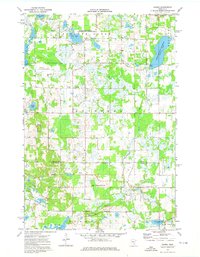
1974 Map of Crown
USGS Topo · Published 1976About this map
Glacial lakes and wetlands define the border between Isanti and Anoka counties in the mid-1970s. The landscape is a mix of protected wildlife areas and rural townships, including Spencer Brook and Stanford. Small settlements like Crown and Oxlip serve as local hubs, while the southern portion of the map shows the emerging St Francis corporate boundary. The area's social fabric is visible through long-standing community landmarks such as Zion Sch and the Evangelical Free Ch, alongside cemeteries like Lakeside Cem and Oak View Cem.
Find a feature on this map
32 named features on this map. Tap any name to fly to it.
Don’t see what you’re looking for? This feature index may not catch every label — zoom into the map to look around manually.
Map Details
Editions of this 1974 Crown Map
This is the sole edition of this map. No revisions or reprints were ever made.
Other maps of this area

1916 · St. Francis
USGS Topo · 1:62,500

1919 · St. Francis
USGS Topo · 1:62,500

1953 · Stillwater
USGS Topo · 1:250,000

1955 · Stillwater
USGS Topo · 1:250,000

1958 · Stillwater
USGS Topo · 1:250,000

1961 · Bradford
USGS Topo · 1:24,000

1961 · Lake Fremont
USGS Topo · 1:24,000

1961 · Elk River
USGS Topo · 1:24,000

1961 · Wyanett
USGS Topo · 1:24,000

1961 · Elk River
USGS Topo · 1:62,500