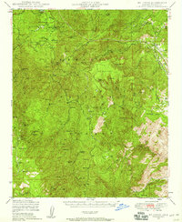
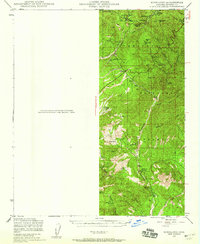
1947 Map of Crown King
USGS Topo · Published 1955About this map
Crown King and the surrounding high-altitude mining districts are captured here during a transition from an industrial extraction economy to a mid-century recreational landscape. The map reveals an incredible density of hard-rock mines, including the Crown King Mine, Oro Belle Mine, and Gladiator Mines, which once fueled the local economy. These sites are clustered along the steep drainages of the Bradshaw Mountains, accessible by the winding Senator Hwy. The presence of the Crown King Ranger Sta and the Horsethief Basin Recreation Area indicates the area's growing importance for public land management and mountain getaways by the late 1940s. Beyond the larger camps, smaller named locations like Paxton Place, Minnehaha, and the provocatively named Fort Misery provide specific targets for local history research, showing the scattered nature of early Arizona mountain settlements.
Find a feature on this map
74 named features on this map. Tap any name to fly to it.
Don’t see what you’re looking for? This feature index may not catch every label — zoom into the map to look around manually.
Map Details
Editions of this 1947 Crown King Map
This is the sole edition of this map. No revisions or reprints were ever made.
Other maps of this area

1887 · Prescott
USGS Topo · 1:250,000

1892 · Prescott
USGS Topo · 1:250,000

1903 · Bradshaw Mountains
USGS Topo · 1:125,000

1903 · Congress
USGS Topo · 1:125,000

1904 · Congress
USGS Topo · 1:125,000
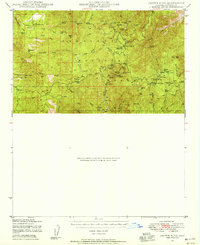
1947 · Bumblebee
USGS Topo · 1:62,500
1947 · Mayer
USGS Topo · 1:62,500
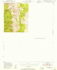
1947 · Mt. Union
USGS Topo · 1:62,500
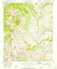
1947 · Kirkland
USGS Topo · 1:62,500
1947 · Wagoner
USGS Topo · 1:62,500