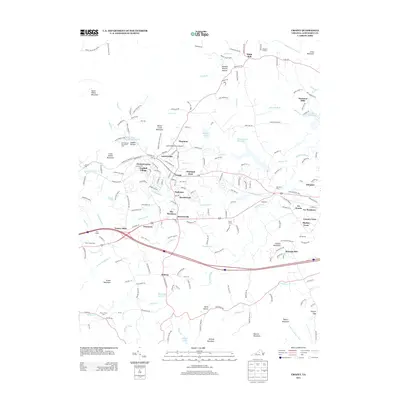
2013 Map of Crozet
USGS Topo · Published 2013About this map
Crozet sits at the heart of this Albemarle County landscape, surrounded by a ring of historic residential clusters including Wayland Park, Orchard Acres, and Brookwood. The area's agricultural roots remain visible through established properties like Maupins Orchard to the north and the sprawling Seven Oaks Farm near Yancey Mills. The terrain is defined by the transition from the Blue Ridge foothills at Bucks Elbow Mountain and Jarman Gap down toward the Mechums River valley. To the north, the Beaver Creek Reservoir and the Mint Springs Recreation Area provide significant water features, while the smaller Crozet Water Supply Reservoir serves the immediate community. Transportation patterns show a mix of old corridors like the Three Notched Trce and modern infrastructure, including the Cottonwood Farm Airport and a series of smaller named settlements such as Freetown and Thurston that indicate the dense historical fabric of the region.
Find a feature on this map
179 named features on this map. Tap any name to fly to it.
Don’t see what you’re looking for? This feature index may not catch every label — zoom into the map to look around manually.
Map Details
Editions of this 2013 Crozet Map
This is the sole edition of this map. No revisions or reprints were ever made.
Other maps of this area

1892 · Buckingham
USGS Topo · 1:125,000

1892 · Harrisonburg
USGS Topo · 1:125,000

1929 · Covesville
USGS Topo · 1:62,500

1931 · University
USGS Topo · 1:62,500

1934 · Waynesboro
USGS Topo · 1:48,000

1935 · Covesville
USGS Topo · 1:62,500

1935 · University
USGS Topo · 1:62,500

1939 · Waynesboro
USGS Topo · 1:62,500

1943 · Lovingston
USGS Topo · 1:62,500

1945 · Covesville
USGS Topo · 1:62,500