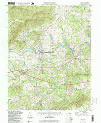
1997 Map of Crozet
USGS Topo · Published 1999About this map
Crozet serves as the central hub of this Albemarle County landscape, situated at the base of the Blue Ridge where the CSX railroad cuts through the terrain. The map reveals a cluster of historical communities along the base of Bucks Mountain and Elbow Mountain, including White Hall, Yancey Mills, and Brownsville. These settlements are linked by a network of winding roads and local landmarks like Henley Sch and the expansive Miller School campus to the south.
Find a feature on this map
64 named features on this map. Tap any name to fly to it.
Don’t see what you’re looking for? This feature index may not catch every label — zoom into the map to look around manually.
Map Details
Editions of this 1997 Crozet Map
This is the sole edition of this map. No revisions or reprints were ever made.
Other maps of this area

1892 · Buckingham
USGS Topo · 1:125,000

1892 · Harrisonburg
USGS Topo · 1:125,000

1929 · Covesville
USGS Topo · 1:62,500

1931 · University
USGS Topo · 1:62,500

1934 · Waynesboro
USGS Topo · 1:48,000

1935 · Covesville
USGS Topo · 1:62,500

1935 · University
USGS Topo · 1:62,500

1939 · Waynesboro
USGS Topo · 1:62,500

1943 · Lovingston
USGS Topo · 1:62,500

1945 · Covesville
USGS Topo · 1:62,500