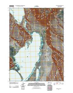
2011 Map of Crump Lake
USGS Topo · Published 2011About this map
Crump Lake and Hart Lake dominate this high-desert basin in southeastern Oregon, connected by a slender passage known as The Narrows. This early twenty-first-century topographic record shows the interconnected hydrology of the Warner Valley, where water flows from Fish Creek into these expansive, shallow basins. To the north, a crossing at Stone Bridge provides passage between the lakes, while the eastern horizon is defined by the steep rises of Riffle Canyon and Fisher Canyon. The map preserves the location of Calderwood Ranch on the edge of the Big Flat, reflecting the area's long-standing reliance on ranching and seasonal water sources. The landscape is characterized by its wide, flat basins and the dramatic breaks of the surrounding rims, illustrating the stark geography of Lake County.
Find a feature on this map
10 named features on this map. Tap any name to fly to it.
Don’t see what you’re looking for? This feature index may not catch every label — zoom into the map to look around manually.
Map Details
Editions of this 2011 Crump Lake Map
This is the sole edition of this map. No revisions or reprints were ever made.
Other maps of this area

1955 · Adel
USGS Topo · 1:250,000

1957 · Adel
USGS Topo · 1:250,000

1958 · Adel
USGS Topo · 1:250,000

1962 · Adel
USGS Topo · 1:250,000

1967 · Jacobs Reservoir
USGS Topo · 1:24,000

1967 · Plush
USGS Topo · 1:24,000

1967 · Priday Reservoir
USGS Topo · 1:24,000

1967 · Hart Lake
USGS Topo · 1:24,000

1967 · Warner Peak
USGS Topo · 1:24,000

1967 · Crump Lake
USGS Topo · 1:24,000