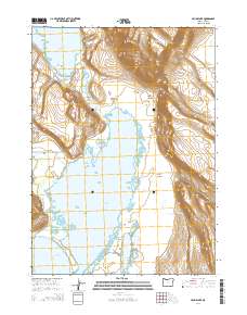
2014 Map of Crump Lake
USGS Topo · Published 2014About this map
Warner Valley's high desert basin is defined by the significant hydrologic features of Crump Lake and Hart Lake, which are connected by a slender passage known as The Narrows. This 2014 survey documents a landscape of dramatic vertical relief, where the massive rise of Hart Mtn looms over the eastern edge of the valley. Local transportation is anchored by the Plush Adel Rd, which skirts the western wetlands. Water remains the primary architect of the geography here, evidenced by the intricate shorelines of Fisher Lake, Wool Lake, and Mud Lk. Geological and thermal activity is visible in labels for Hot Springs and the deeply carved paths of Fisher Canyon and Riffle Canyon. The map preserves the location of Stone Bridge, a critical crossing point between the major lakes in this remote corner of Lake County.
Find a feature on this map
19 named features on this map. Tap any name to fly to it.
Don’t see what you’re looking for? This feature index may not catch every label — zoom into the map to look around manually.
Map Details
Editions of this 2014 Crump Lake Map
This is the sole edition of this map. No revisions or reprints were ever made.
Other maps of this area

1955 · Adel
USGS Topo · 1:250,000

1957 · Adel
USGS Topo · 1:250,000

1958 · Adel
USGS Topo · 1:250,000

1962 · Adel
USGS Topo · 1:250,000

1967 · Jacobs Reservoir
USGS Topo · 1:24,000

1967 · Plush
USGS Topo · 1:24,000

1967 · Priday Reservoir
USGS Topo · 1:24,000

1967 · Hart Lake
USGS Topo · 1:24,000

1967 · Warner Peak
USGS Topo · 1:24,000

1967 · Crump Lake
USGS Topo · 1:24,000