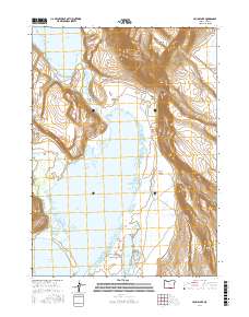
2017 Map of Crump Lake
USGS Topo · Published 2017About this map
Warner Valley forms the central character of this high-desert landscape in southeastern Oregon, where a series of expansive, shallow water bodies dominate the basin floor. The hydrologic connection between Hart Lake and Crump Lake is constrained by The Narrows and bridged by the aptly named Stone Bridge, illustrating the delicate water management required in this arid region. To the east, the dramatic elevation of Hart Mtn rises sharply from the valley, cut by deep erosional features like Riffle Canyon and Fisher Canyon. Geothermal activity is indicated by the presence of Hot Springs near the base of the mountains, while more ephemeral features like Wool Lake and Fisher Lake populate the lower reaches. This survey provides a clear look at the township and range grid (T37S R24E through T38S R25E) overlaying a terrain defined by stark contrasts between wetland basins and high-rim rock.
Find a feature on this map
18 named features on this map. Tap any name to fly to it.
Don’t see what you’re looking for? This feature index may not catch every label — zoom into the map to look around manually.
Map Details
Editions of this 2017 Crump Lake Map
This is the sole edition of this map. No revisions or reprints were ever made.
Other maps of this area

1955 · Adel
USGS Topo · 1:250,000

1957 · Adel
USGS Topo · 1:250,000

1958 · Adel
USGS Topo · 1:250,000

1962 · Adel
USGS Topo · 1:250,000

1967 · Jacobs Reservoir
USGS Topo · 1:24,000

1967 · Plush
USGS Topo · 1:24,000

1967 · Priday Reservoir
USGS Topo · 1:24,000

1967 · Hart Lake
USGS Topo · 1:24,000

1967 · Warner Peak
USGS Topo · 1:24,000

1967 · Crump Lake
USGS Topo · 1:24,000