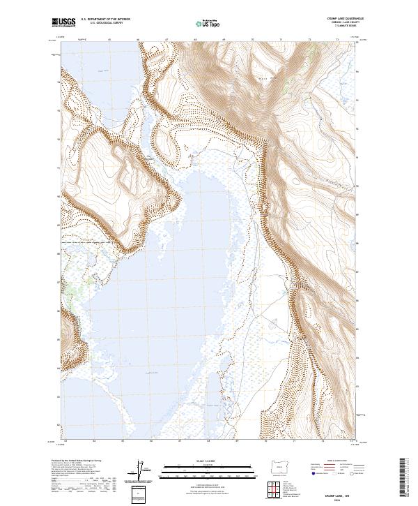
2024 Map of Crump Lake
USGS Topo · Published 2024About this map
Hart Mountain National Antelope Refuge dominates the northeastern portion of this High Desert landscape, where the dramatic rise of Hart Mtn overlooks the Warner Valley. This 2024 survey captures the intricate hydrologic connection between the valley's large alkaline basins, showing how Hart Lake feeds south through The Narrows into the expansive Crump Lake. This waterway system, supported by the seasonal flow of Fish Creek, defines the local geography and creates a distinct wetland environment including Fisher Lake to the south. The terrain transition is sharp, moving from the open waters and marshes of the valley floor to the steep, indented slopes of Fisher Canyon and Riffle Canyon. While human infrastructure is sparse, the presence of Co Hwy 3-10 and Hogback Rd provides the primary access points for this protected wilderness area.
Find a feature on this map
17 named features on this map. Tap any name to fly to it.
Don’t see what you’re looking for? This feature index may not catch every label — zoom into the map to look around manually.
Map Details
Editions of this 2024 Crump Lake Map
This is the sole edition of this map. No revisions or reprints were ever made.
Other maps of this area

1955 · Adel
USGS Topo · 1:250,000

1957 · Adel
USGS Topo · 1:250,000

1958 · Adel
USGS Topo · 1:250,000

1962 · Adel
USGS Topo · 1:250,000

1967 · Jacobs Reservoir
USGS Topo · 1:24,000

1967 · Plush
USGS Topo · 1:24,000

1967 · Priday Reservoir
USGS Topo · 1:24,000

1967 · Hart Lake
USGS Topo · 1:24,000

1967 · Warner Peak
USGS Topo · 1:24,000

1967 · Crump Lake
USGS Topo · 1:24,000