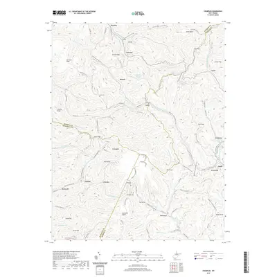
2019 Map of Crumpler
USGS Topo · Published 2019About this map
Ashland and Crumpler occupy a complex landscape of sharp ridges and deep hollows at the intersection of McDowell, Mercer, and Wyoming counties. This 2019 survey documents the settlement patterns of the West Virginia coalfields, where communities like Cherokee, McComas, and Weyanoke are tied to the winding watercourses of N Fork Elkhorn Cr and Crane Creek. The geography is defined by prominent high points such as Indian Ridge, Pilot Knob, and Pinnacle Ridge, which separate the various forks of Widemouth Cr. Local history is preserved in landmarks like the Prosperity School and Bailey Cem, while the infrastructure of the region is illustrated by the Norfolk Ashland Rd and a network of secondary routes like Covel-Gooney Otter-Hollow Rd and the Windmill Gap-Prosperity Rd that navigate the difficult terrain through passes like Clark Gap and Peters Gap.
Find a feature on this map
109 named features on this map. Tap any name to fly to it.
Don’t see what you’re looking for? This feature index may not catch every label — zoom into the map to look around manually.
Map Details
Editions of this 2019 Crumpler Map
This is the sole edition of this map. No revisions or reprints were ever made.
Other maps of this area

1887 · Pocahontas
USGS Topo · 1:125,000

1891 · Pocahontas
USGS Topo · 1:125,000

1891 · Raleigh
USGS Topo · 1:125,000

1894 · Pocahontas
USGS Topo · 1:125,000

1895 · Pocahontas
USGS Topo · 1:125,000

1897 · Raleigh
USGS Topo · 1:125,000

1902 · Raleigh
USGS Topo · 1:125,000

1909 · Pocahontas Special
USGS Topo · 1:48,000

1911 · Flattop
USGS Topo · 1:48,000

1911 · Pocahontas Special
USGS Topo · 1:62,500