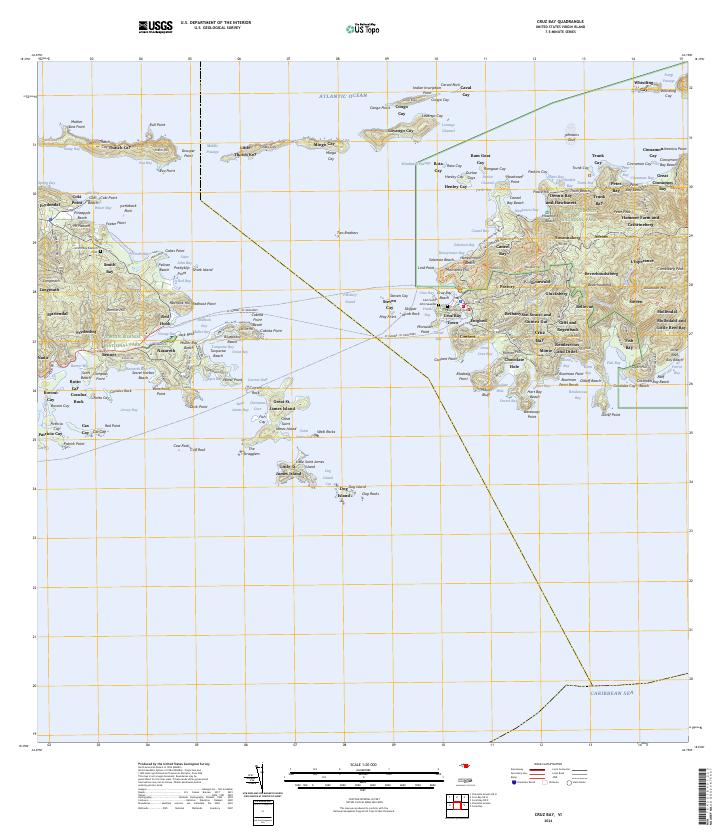
2024 Map of Cruz Bay
USGS Topo · Published 2024About this map
Cruz Bay Town and the surrounding hillsides of Saint John appear in high detail on this contemporary survey, showing the complex boundary between the Virgin Islands National Park and established local settlements. The map traces the vital St Thomas - St John Ferry route across the Windward Passage, connecting the bustling docks of Red Hook on Saint Thomas with the administrative heart of Saint John. For the local historian or genealogist, the map preserves the location of traditional estates and burial grounds such as the Beverhoudt Cem and the Cem Saint John Seaside. Inland, the terrain is marked by named settlements like San Soucci and Guinea Gut and L'Esperance, while the shoreline is dotted with famous beaches from Trunk Bay to Cinnamon Bay. This edition serves as a precise record of modern roads like Northshore Road RT-020 and Centerline Rd as they navigate the steep island topography.
Find a feature on this map
190 named features on this map. Tap any name to fly to it.
Don’t see what you’re looking for? This feature index may not catch every label — zoom into the map to look around manually.
Map Details
Editions of this 2024 Cruz Bay Map
This is the sole edition of this map. No revisions or reprints were ever made.
Other maps of this area
1954 · Eastern St. Thomas
USGS Topo · 1:24,000
1958 · Western St. John
USGS Topo · 1:24,000
2013 · Charlotte Amalie
USGS Topo · 1:20,000
2013 · Cruz Bay OE N
USGS Topo · 1:20,000
2013 · Coral Bay
USGS Topo · 1:20,000
2013 · Cruz Bay
USGS Topo · 1:20,000
2013 · Coral Bay OE N
USGS Topo · 1:20,000
2013 · Charlotte Amalie OE N
USGS Topo · 1:20,000
2024 · Coral Bay OE N
USGS Topo · 1:20,000
2024 · Coral Bay
USGS Topo · 1:20,000
Featured Places
- Anna's Retreat, Saint Thomas - Saint John District
- Cruz Bay, Saint Thomas - Saint John District
- Adrian, Saint Thomas - Saint John District
- Dennis Bay Historic District, Saint Thomas - Saint John District
- Monte, Saint Thomas - Saint John District