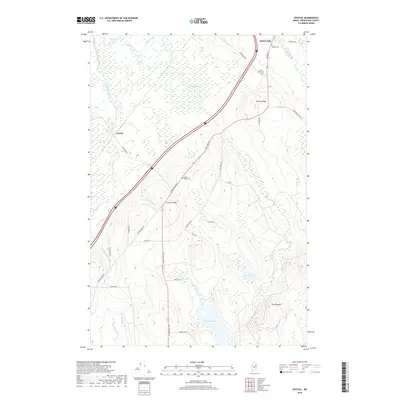
2018 Map of Crystal
USGS Topo · Published 2018About this map
Island Falls and the settlement of Crystal anchor this 2018 survey of Aroostook County, Maine. The landscape is defined by its complex drainage and wetland systems, notably the expansive Thousand Acre Bog and the waters of Macwahoc Lake and Cold Brook Lake. Local history is preserved in small burial grounds like Village Cem, Saint Agnes Cem, and Golden Ridge Cem, which serve as quiet markers of the community's lineage.
Find a feature on this map
40 named features on this map. Tap any name to fly to it.
Don’t see what you’re looking for? This feature index may not catch every label — zoom into the map to look around manually.
Map Details
Editions of this 2018 Crystal Map
This is the sole edition of this map. No revisions or reprints were ever made.
Other maps of this area

1937 · Smyrna Mills
USGS Topo · 1:62,500

1940 · Island Falls
USGS Topo · 1:62,500

1940 · Sherman
USGS Topo · 1:62,500

1941 · Mattawamkeag Lake
USGS Topo · 1:62,500

1942 · Island Falls
USGS Topo · 1:62,500

1942 · Sherman
USGS Topo · 1:62,500

1943 · Mattawamkeag Lake
USGS Topo · 1:62,500

1954 · Presque Isle
USGS Topo · 1:250,000

1954 · Millinocket
USGS Topo · 1:250,000

1955 · Smyrna Mills
USGS Topo · 1:62,500