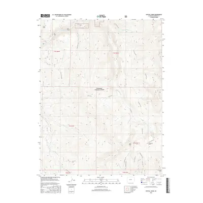
2016 Map of Crystal Creek
USGS Topo · Published 2016About this map
Gunnison National Forest encompasses the high-altitude terrain of this Colorado quadrangle, where steep drainages and prominent ridges define the landscape. The Taylor River cuts through the northern section, creating the dramatic Taylor Canyon and receiving flow from tributaries like Fivemile Creek and Crystal Creek. This 2016 survey illustrates an intricate network of backcountry access, including the Seely Trail and Van Tuyl Trail, which cross the central mountains. To the southeast, the geography rises toward the significant formation of Fossil Ridge, flanked by the Fossil Ridge Trail and Fossil Bypass Trail. The area is characterized by these primitive routes and multiple forks of Alder Creek, reflecting a region dedicated to conservation and seasonal wilderness transit rather than permanent settlement.
Find a feature on this map
35 named features on this map. Tap any name to fly to it.
Don’t see what you’re looking for? This feature index may not catch every label — zoom into the map to look around manually.
Map Details
Editions of this 2016 Crystal Creek Map
This is the sole edition of this map. No revisions or reprints were ever made.
Other maps of this area

1888 · Crested Butte
USGS Topo · 1:62,500

1889 · Crested Butte
USGS Topo · 1:62,500

1893 · Crested Butte
USGS Topo · 1:62,500

1934 · Taylor Park
USGS Topo · 1:62,500

1937 · Taylor Park
USGS Topo · 1:62,500

1941 · Pitkin
USGS Topo · 1:62,500

1945 · Pitkin
USGS Topo · 1:62,500

1956 · Montrose
USGS Topo · 1:250,000

1959 · Montrose
USGS Topo · 1:250,000

1960 · Montrose
USGS Topo · 1:250,000