
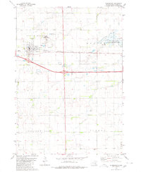
1979 Map of Crystal Lake
USGS Topo · Published 1980About this map
Crystal Lake and the surrounding prairie wetlands of Plankinton and Eureka townships define this corner of Aurora County during the late 1970s. The landscape is characterized by a high density of conservation land, including the National Waterfowl Production Area and the Crystal Lake State Public Shooting Area, reflecting the region's importance for migratory birds and local sportsmen. Infrastructure is anchored by the Chicago Milwaukee St Paul and Pacific railroad corridor, which runs parallel to Interstate 90. Isolated features such as a Flowing Well and several other marked wells indicate the agricultural reliance on groundwater across these rural sections. The township of Pleasant Lake sits adjacent to the primary water bodies, documenting a period of established land management and transportation development.
Find a feature on this map
12 named features on this map. Tap any name to fly to it.
Don’t see what you’re looking for? This feature index may not catch every label — zoom into the map to look around manually.
Map Details
Editions of this 1979 Crystal Lake Map
This is the sole edition of this map. No revisions or reprints were ever made.
Other maps of this area

1899 · Mitchell
USGS Topo · 1:125,000

1942 · Crow Lake
USGS Topo · 1:62,500

1955 · Mitchell
USGS Topo · 1:250,000

1959 · Mitchell
USGS Topo · 1:250,000

1979 · Laffey Lake
USGS Topo · 1:24,000

1979 · White Lake
USGS Topo · 1:24,000

1979 · Aurora Center
USGS Topo · 1:24,000

1979 · Storla SW
USGS Topo · 1:24,000

1980 · Stickney
USGS Topo · 1:24,000
1980 · Plankinton
USGS Topo · 1:24,000
Featured Places
- Eureka Township, SD
- Plankinton Township, SD
- Pleasant Lake Township, SD
- Crystal Lake Township, SD
- Aurora County, SD