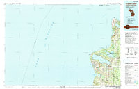
1984 Map of Crystal Lake
USGS Topo · Published 1991About this map
Sleeping Bear Dunes National Lakeshore dominates the northern shoreline in this mid-1980s look at the Michigan coast, where the glacial landscape creates a complex network of inland waters and dramatic bluffs. The map captures the transition from the protected federal lands of Sleeping Bear Dunes and Sleeping Bear Point down to the established harbor towns of Frankfort and Elberta. Settlements like Beulah and Benzonia are shown established at the eastern edge of Crystal Lake, while smaller crossroads like Joyfield and Putney Corners anchor the interior farming and timber districts. Extensive state holdings are visible through the Pere Marquette State Forest and the Betsie River State Game Refuge, illustrating the era's balance between conservation and local development. The coastal geography is marked by distinctive points such as Lighthouse Point Betsie and Platte River Point, which have historically guided maritime traffic through the Manitou Passage of Lake Michigan.
Find a feature on this map
67 named features on this map. Tap any name to fly to it.
Don’t see what you’re looking for? This feature index may not catch every label — zoom into the map to look around manually.
Map Details
Editions of this 1984 Crystal Lake Map
2 editions found
Other maps of this area

1954 · Traverse City
USGS Topo · 1:250,000

1954 · Escanaba
USGS Topo · 1:250,000

1954 · Manitowoc
USGS Topo · 1:250,000

1955 · Cheboygan
USGS Topo · 1:250,000

1956 · Onekama
USGS Topo · 1:62,500

1956 · North Manitou
USGS Topo · 1:62,500

1956 · Bar Lake
USGS Topo · 1:62,500

1956 · Thompsonville
USGS Topo · 1:62,500

1956 · Frankfort
USGS Topo · 1:62,500

1957 · Escanaba
USGS Topo · 1:250,000