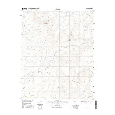
2017 Map of Crystal
USGS Topo · Published 2017About this map
The settlement of Crystal sits at the southwestern edge of the high-elevation Chuska Mountains, where the landscape transitions into the deep drainages of Black Salt Valley and Red Valley. This 2017 study illustrates a network of Bureau of Indian Affairs routes, such as Indian Svc Rte 32 and Indian Svc Rte 7110, that connect the high-country peaks to the canyon floors. High-altitude hydrology is a defining characteristic, with several named alpine bodies of water including Todacheene Lake, Berland Lake, and Sage Lake tucked among the ridges. An interesting industrial remnant is noted by the label Old Min Rd, hinting at past extraction efforts in this mountainous terrain. The map also records the jurisdictional boundary between San Juan and McKinley Counties crossing through the southern portion of the quadrangle.
Find a feature on this map
25 named features on this map. Tap any name to fly to it.
Don’t see what you’re looking for? This feature index may not catch every label — zoom into the map to look around manually.
Map Details
Editions of this 2017 Crystal Map
This is the sole edition of this map. No revisions or reprints were ever made.
Other maps of this area

1886 · Wingate
USGS Topo · 1:250,000

1886 · Fort Defiance
USGS Topo · 1:250,000

1889 · Chaco
USGS Topo · 1:250,000

1892 · Fort Defiance
USGS Topo · 1:250,000

1892 · Wingate
USGS Topo · 1:250,000

1892 · Chaco
USGS Topo · 1:250,000

1892 · Canyon De Chelly
USGS Topo · 1:250,000

1954 · Shiprock
USGS Topo · 1:250,000

1954 · Gallup
USGS Topo · 1:250,000

1955 · Sonsala Butte 4 SE
USGS Topo · 1:24,000
Featured Places
- Shiprock Agency
- Fort Defiance Agency
- Áshįįshzhiin, Fort Defiance Agency
- Crystal, Fort Defiance Agency
- San Juan County, NM