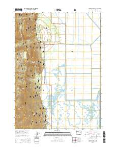
2014 Map of Crystal Spring
USGS Topo · Published 2014About this map
Crystal Spring lies at the transition between the steep timbered slopes of the Winema National Forest and the vast marshlands bordering Agency Lake. This landscape is defined by its complex hydrology, where numerous freshwater sources like Tiger Lily Spring, South Mound Spring, and Malone Spring feed into a network of natural and engineered waterways. The presence of the Sevenmile Canal and Fourmile Canal, alongside the Levee near the lake's edge, indicates a long history of water management and land reclamation in this part of Klamath County.
Find a feature on this map
30 named features on this map. Tap any name to fly to it.
Don’t see what you’re looking for? This feature index may not catch every label — zoom into the map to look around manually.
Map Details
Editions of this 2014 Crystal Spring Map
This is the sole edition of this map. No revisions or reprints were ever made.
Other maps of this area

1889 · Klamath
USGS Topo · 1:250,000

1891 · Ashland
USGS Topo · 1:250,000

1893 · Ashland
USGS Topo · 1:250,000

1894 · Klamath
USGS Topo · 1:250,000

1897 · Ashland
USGS Topo · 1:250,000

1955 · Lake O' Woods
USGS Topo · 1:62,500

1955 · Pelican Butte
USGS Topo · 1:62,500

1955 · Klamath Falls
USGS Topo · 1:250,000

1955 · Medford
USGS Topo · 1:250,000

1957 · Medford
USGS Topo · 1:250,000