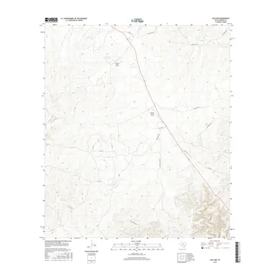
2016 Map of Cub Lake
USGS Topo · Published 2016About this map
Cub Lake and the surrounding rangeland of Edwards County define this interior portion of the Edwards Plateau. The landscape is marked by a network of drainage systems including Indian Cr and Little Hackberry Cr, leading toward Pulliam Cr in the south. Ranching infrastructure and aviation connectivity are central to the area's development, evidenced by the Freeman Ranch Airport and the Edwards County Airport.
Find a feature on this map
23 named features on this map. Tap any name to fly to it.
Don’t see what you’re looking for? This feature index may not catch every label — zoom into the map to look around manually.
Map Details
Editions of this 2016 Cub Lake Map
This is the sole edition of this map. No revisions or reprints were ever made.
Other maps of this area

1893 · Rock Springs
USGS Topo · 1:125,000

1893 · Nueces
USGS Topo · 1:125,000

1896 · Nueces
USGS Topo · 1:125,000

1944 · Indian Creek
USGS Topo · 1:62,500

1947 · Hackberry
USGS Topo · 1:62,500

1954 · Sonora
USGS Topo · 1:250,000

1958 · Sonora
USGS Topo · 1:250,000

1958 · Del Rio
USGS Topo · 1:250,000

1964 · Del Rio
USGS Topo · 1:250,000
1971 · Ray Lake SE
USGS Topo · 1:24,000