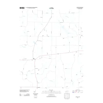
2013 Map of Cuba
USGS Topo · Published 2013About this map
Pilot Oak and the surrounding farmland of southern Graves County are the primary focus of this early 21st-century study. The landscape is defined by the winding drainages of Obion Cr, Brush Cr, and Bayou de Chien, which carve through a network of rural roads such as Pea Ridge Rd and Waggoner Bottom Rd. This agricultural region preserves a high density of family and community burial grounds, offering significant value for genealogical research in western Kentucky.
Find a feature on this map
73 named features on this map. Tap any name to fly to it.
Don’t see what you’re looking for? This feature index may not catch every label — zoom into the map to look around manually.
Map Details
Editions of this 2013 Cuba Map
This is the sole edition of this map. No revisions or reprints were ever made.
Other maps of this area

1936 · Farmington
USGS Topo · 1:24,000

1951 · Farmington
USGS Topo · 1:24,000

1952 · Mayfield
USGS Topo · 1:24,000

1952 · Dublin
USGS Topo · 1:24,000

1952 · Cuba
USGS Topo · 1:24,000

1952 · Water Valley
USGS Topo · 1:24,000

1952 · Mayfield
USGS Topo · 1:62,500

1952 · Water Valley
USGS Topo · 1:62,500
1952 · Lynnville
USGS Topo · 1:24,000

1956 · Mc Connell
USGS Topo · 1:24,000