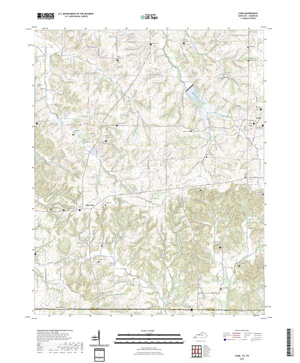
2022 Map of Cuba
USGS Topo · Published 2022About this map
Pilot Oak and Cuba anchor this rural landscape in Graves County, where the terrain is defined by a dense network of headwaters including Bayou de Chien, Obion Cr, and Blackamore Cr. The map reveals a deeply rooted community structure centered on family and congregational history, evidenced by more than twenty named burial grounds. Significant sites such as the Pilot Oak Baptist Cem, Cuba Baptist Cem, and the Colley Family Cem suggest long-standing generational ties to the land. The road network follows the undulating topography between stream valleys, connecting landmarks like Little Bethel Cem and Poyners Chapel Cem across the state line between Kentucky and Tennessee. This survey documents the intersection of agricultural life and historical preservation in the Jackson Purchase region.
Find a feature on this map
88 named features on this map. Tap any name to fly to it.
Don’t see what you’re looking for? This feature index may not catch every label — zoom into the map to look around manually.
Map Details
Editions of this 2022 Cuba Map
This is the sole edition of this map. No revisions or reprints were ever made.
Other maps of this area

1936 · Farmington
USGS Topo · 1:24,000

1951 · Farmington
USGS Topo · 1:24,000

1952 · Mayfield
USGS Topo · 1:24,000

1952 · Dublin
USGS Topo · 1:24,000

1952 · Cuba
USGS Topo · 1:24,000

1952 · Water Valley
USGS Topo · 1:24,000

1952 · Mayfield
USGS Topo · 1:62,500

1952 · Water Valley
USGS Topo · 1:62,500
1952 · Lynnville
USGS Topo · 1:24,000

1956 · Mc Connell
USGS Topo · 1:24,000