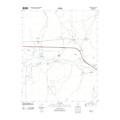
2010 Map of Cubero
USGS Topo · Published 2010About this map
Rio San Jose winds through a landscape of mesas and high-desert settlements in this early 21st-century survey. The region is defined by its deep cultural ties, seen in the proximity of San Fidel, Acomita, and North Acomita Village. Transportation and water management are central to the area's development, with the Paraje Irrigation Ditch and Acomita Reservoir Dam supporting the local environment alongside the historical path of Old 66. The layout of the small communities, including the distinct clusters at West Village and Villa de Cubero, reflects a pattern of settlement closely tied to the valley floor and the surrounding terrain of Flower Mountain and Paraje Mesa. Local history is anchored by landmarks like the San Fidel Parish House Belfrey and the Cubero Post Office, while the inclusion of the San Fidel Cemetery and Budville Cemetery provides essential geographic references for genealogical research in this part of Cibola County.
Find a feature on this map
56 named features on this map. Tap any name to fly to it.
Don’t see what you’re looking for? This feature index may not catch every label — zoom into the map to look around manually.
Map Details
Editions of this 2010 Cubero Map
This is the sole edition of this map. No revisions or reprints were ever made.
Other maps of this area

1883 · Mt. Taylor
USGS Topo · 1:250,000

1886 · Mt. Taylor
USGS Topo · 1:250,000

1892 · Mt. Taylor
USGS Topo · 1:250,000

1899 · Mt. Taylor
USGS Topo · 1:250,000

1917 · Cerro Verde
USGS Topo · 1:125,000

1917 · Broom Mountain
USGS Topo · 1:125,000

1954 · Socorro
USGS Topo · 1:250,000

1957 · Lobo Springs
USGS Topo · 1:24,000

1957 · Mount Taylor
USGS Topo · 1:24,000

1957 · Laguna
USGS Topo · 1:24,000