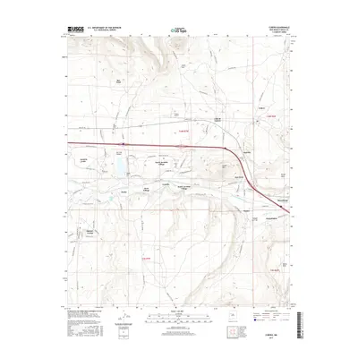
2017 Map of Cubero
USGS Topo · Published 2017About this map
The Rio San Jose corridor defines this portion of western New Mexico, where ancient travel routes and modern settlements converge beneath the heights of Flower Mtn. This landscape is characterized by a dense concentration of interconnected communities, including San Fidel, Villa de Cubero, and Budville, which grew along the historic Hst Rte 66. The mapping of indigenous settlements like North Acomita Village, South Acomita Village, and Skyline-Ganipa reflects the deep ancestral roots of the region. Local transit and agricultural history are visible in features such as the Paraje Irrigation Ditch and remnants like Wagon Trl, while the Cubero Airport indicates the mid-century evolution of local transportation. Genealogists will find particular value in the documentation of the San Fidel Cem and Budville Cem, which anchor these historic villages to their residents.
Find a feature on this map
86 named features on this map. Tap any name to fly to it.
Don’t see what you’re looking for? This feature index may not catch every label — zoom into the map to look around manually.
Map Details
Editions of this 2017 Cubero Map
This is the sole edition of this map. No revisions or reprints were ever made.
Other maps of this area

1883 · Mt. Taylor
USGS Topo · 1:250,000

1886 · Mt. Taylor
USGS Topo · 1:250,000

1892 · Mt. Taylor
USGS Topo · 1:250,000

1899 · Mt. Taylor
USGS Topo · 1:250,000

1917 · Cerro Verde
USGS Topo · 1:125,000

1917 · Broom Mountain
USGS Topo · 1:125,000

1954 · Socorro
USGS Topo · 1:250,000

1957 · Lobo Springs
USGS Topo · 1:24,000

1957 · Mount Taylor
USGS Topo · 1:24,000

1957 · Laguna
USGS Topo · 1:24,000