2023 Map of Cubero
USGS Topo · Published 2023About this map
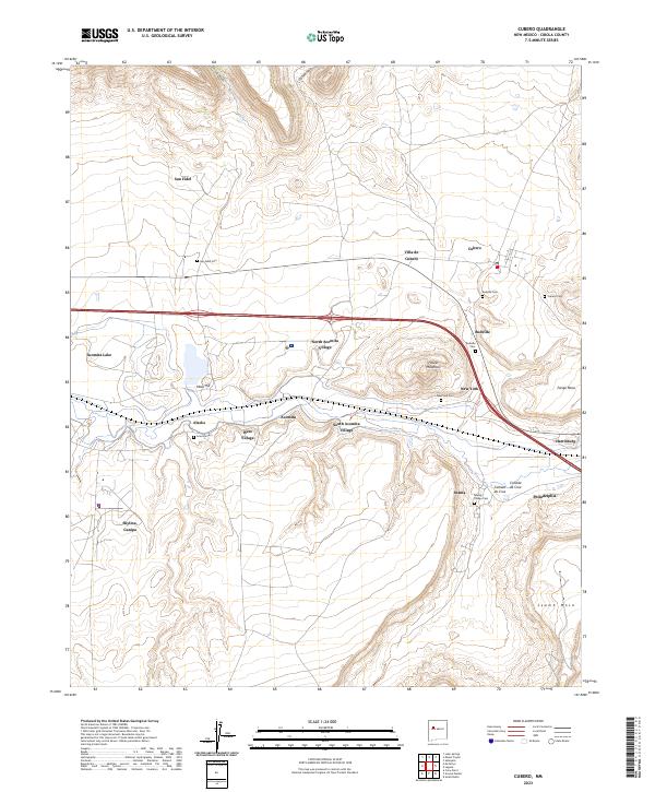
San Fidel and the neighboring settlements of Villa de Cubero and Budville occupy the high desert landscape between San Jose Canyon and the expansive Seama Mesa. This 2023 survey illustrates a complex pattern of residential clusters such as North Acomita Village, South Acomita Village, and West Village, which are tightly integrated with the terrain of the Paraje Mesa and Mesa Hill. The modernization of the corridor is dominated by the path of I-40, which bisects the quadrangle and connects these historic communities.
Find a feature on this map
33 named features on this map. Tap any name to fly to it.
Don’t see what you’re looking for? This feature index may not catch every label — zoom into the map to look around manually.
Map Details
Editions of this 2023 Cubero Map
This is the sole edition of this map. No revisions or reprints were ever made.