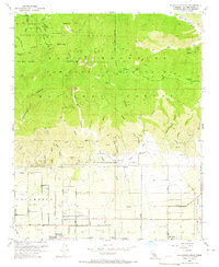
1953 Map of Cucamonga Peak
USGS Topo · Published 1965About this map
Cucamonga Grant and its agricultural transition define the southern foothills of the San Gabriel Mountains in this early 1950s survey. The landscape is sharply divided between the high wilderness of the Angeles National Forest and the budding citrus and vineyard developments of Alta Loma and Etiwanda. Transport networks are central to the region's character, with the Atchison Topeka and Santa Fe and the Pacific Electric lines running parallel through the alluvial plains. To the north, the terrain rises abruptly toward Cucamonga Peak and Ontario Pk, where a network of trails such as the Telegraph Trail and Shortcut Trail connect remote landmarks like Kelly Camp and the Joe Elliot Tree Memorial. The map also captures the critical water infrastructure of the era, from the Day Canyon Guard Sta to the washes of Deer Creek and Day Creek that supported the growing settlements below.
Find a feature on this map
60 named features on this map. Tap any name to fly to it.
Don’t see what you’re looking for? This feature index may not catch every label — zoom into the map to look around manually.
Map Details
Editions of this 1953 Cucamonga Peak Map
3 editions found
Other maps of this area

1896 · San Bernardino
USGS Topo · 1:62,500

1897 · Cucamonga
USGS Topo · 1:62,500

1898 · San Bernardino
USGS Topo · 1:62,500

1900 · Cucamonga
USGS Topo · 1:62,500

1901 · Southern California Sheet No. 1
USGS Topo · 1:250,000

1901 · San Bernardino
USGS Topo · 1:62,500

1902 · Hesperia
USGS Topo · 1:62,500

1903 · Cucamonga
USGS Topo · 1:62,500

1903 · San Antonio
USGS Topo · 1:62,500

1904 · Southern California Sheet No. 1
USGS Topo · 1:250,000