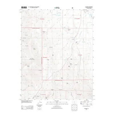
2013 Map of Cuchara
USGS Topo · Published 2013About this map
La Veta and the resort community of Cuchara anchor this study of the Cucharas Valley, where the high peaks of the San Isabel National Forest dominate the western horizon. The landscape is defined by its complex geology and water management, featuring a dense network of irrigation systems including the Butte Ditch, Spanish Peaks Ditch, and Dyer Ditch. Notable vertical landmarks like Goemmer Butte, Raspberry Mountain, and the Devils Stairsteps reflect the unique volcanic dikes that radiate from the Spanish Peaks area.
Find a feature on this map
74 named features on this map. Tap any name to fly to it.
Don’t see what you’re looking for? This feature index may not catch every label — zoom into the map to look around manually.
Map Details
Editions of this 2013 Cuchara Map
This is the sole edition of this map. No revisions or reprints were ever made.
Other maps of this area

1889 · Huerfano Park
USGS Topo · 1:125,000

1891 · Walsenburg
USGS Topo · 1:125,000

1891 · Spanish Peaks
USGS Topo · 1:125,000

1892 · Huerfano Park
USGS Topo · 1:125,000

1893 · Spanish Peaks
USGS Topo · 1:125,000

1894 · Walsenburg
USGS Topo · 1:125,000

1895 · Spanish Peaks
USGS Topo · 1:125,000

1897 · Walsenburg
USGS Topo · 1:125,000

1897 · Spanish Peaks
USGS Topo · 1:125,000

1900 · Spanish Peaks
USGS Topo · 1:125,000