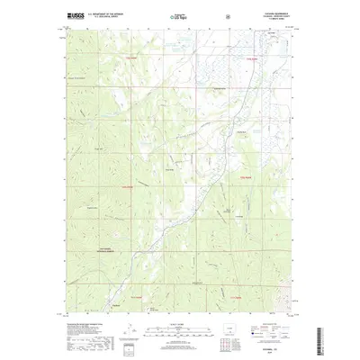
2019 Map of Cuchara
USGS Topo · Published 2019About this map
La Veta and the high country of San Isabel National Forest dominate this topographical study of Huerfano County. The northern edge reveals the water infrastructure of the era, including the H R Carson Reservoir system and the La Veta Town Reservoir, which supported the community at the foot of the Sangre de Cristo foothills. The drainage of the Cucharas River cuts through the center of the sheet, carving deep canyons such as Vories Canyon and Rilling Canyon. Steep vertical features and geological landmarks define the landscape, from the jagged Devils Stairsteps to the prominence of Goemmer Butte and Profile Rock. In the southern reaches, the settlement of Cuchara lies tucked near North White Peak, surrounded by a network of ranch roads and mountain trails including Mountain Valley Rd and the Maverick Trl.
Find a feature on this map
108 named features on this map. Tap any name to fly to it.
Don’t see what you’re looking for? This feature index may not catch every label — zoom into the map to look around manually.
Map Details
Editions of this 2019 Cuchara Map
This is the sole edition of this map. No revisions or reprints were ever made.
Other maps of this area

1889 · Huerfano Park
USGS Topo · 1:125,000

1891 · Walsenburg
USGS Topo · 1:125,000

1891 · Spanish Peaks
USGS Topo · 1:125,000

1892 · Huerfano Park
USGS Topo · 1:125,000

1893 · Spanish Peaks
USGS Topo · 1:125,000

1894 · Walsenburg
USGS Topo · 1:125,000

1895 · Spanish Peaks
USGS Topo · 1:125,000

1897 · Walsenburg
USGS Topo · 1:125,000

1897 · Spanish Peaks
USGS Topo · 1:125,000

1900 · Spanish Peaks
USGS Topo · 1:125,000