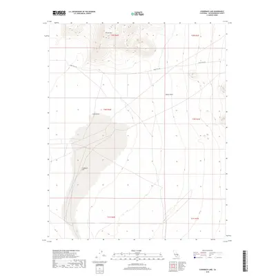
2018 Map of Cuddeback Lake
USGS Topo · Published 2018About this map
Cuddeback Lake dominates this section of the Mojave Desert in San Bernardino County, where the dry lake bed creates a stark, level basin surrounded by the rising elevations of the desert floor. To the north, Almond Mtn provides a significant topographic landmark overlooking Almond Cove, which sits at the northern edge of the playa. The landscape is defined by its arid geometry, with the historic Granit Wells Rd cutting across the northern half of the map, serving as a primary corridor through this high-desert environment. Public land divisions, including t30s r42e and t29s r42e, organize the territory into a grid that contrasts with the fluid contours of the mountains and the ancient shoreline of the lake.
Find a feature on this map
11 named features on this map. Tap any name to fly to it.
Don’t see what you’re looking for? This feature index may not catch every label — zoom into the map to look around manually.
Map Details
Editions of this 2018 Cuddeback Lake Map
This is the sole edition of this map. No revisions or reprints were ever made.
Other maps of this area

1903 · Randsburg
USGS Topo · 1:62,500

1911 · Randsburg
USGS Topo · 1:62,500

1912 · Randsburg
USGS Topo · 1:62,500

1915 · Searles Lake
USGS Topo · 1:250,000

1947 · Trona
USGS Topo · 1:250,000

1948 · Trona
USGS Topo · 1:250,000

1953 · Trona
USGS Topo · 1:250,000
1954 · Boron
USGS Topo · 1:62,500

1954 · Cuddeback Lake
USGS Topo · 1:62,500

1956 · Fremont Peak
USGS Topo · 1:62,500