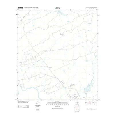
2013 Map of Cuervo Creek
USGS Topo · Published 2013About this map
The Rio Grande defines the southwestern boundary of this South Texas landscape, where the traditional ranching heritage of Webb County meets modern logistics development. Large landholdings like Santa Elena Ranch, Retama Ranch, and the Loma de las Potrancas rise dominate the northern half of the quadrangle, connected by rural routes such as Las Tiendas Rd. Water management is central to this semi-arid environment, evidenced by named features like Middle Pasture Lake, La Presa Azul, and scattered stock tanks.
Find a feature on this map
36 named features on this map. Tap any name to fly to it.
Don’t see what you’re looking for? This feature index may not catch every label — zoom into the map to look around manually.
Map Details
Editions of this 2013 Cuervo Creek Map
This is the sole edition of this map. No revisions or reprints were ever made.
Other maps of this area

1956 · Las Tiendas
USGS Topo · 1:62,500

1956 · Islitas
USGS Topo · 1:62,500

1956 · Laredo East
USGS Topo · 1:62,500

1956 · Webb
USGS Topo · 1:62,500

1956 · Laredo
USGS Topo · 1:250,000

1965 · Laredo West
USGS Topo · 1:24,000

1965 · Orvil
USGS Topo · 1:24,000

1965 · Cuervo Creek
USGS Topo · 1:24,000

1965 · Cerritos Blancos
USGS Topo · 1:24,000

1965 · Nido Ranch
USGS Topo · 1:24,000
Featured Places
- Laredo, TX
- Los Corralitos Colonia, TX
- Los Minerales Colonia, TX
- Ranchos Penitas West, TX
- Ranchos Penitas West Colonia, TX