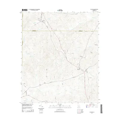
2014 Map of Culloden
USGS Topo · Published 2014About this map
Culloden and Musella anchor this rural landscape in central Georgia, where the boundary between Monroe Co and Crawford Co divides local farmlands and creek valleys. This survey is particularly rich for genealogists, documenting a high density of ancestral burial grounds including the Confederate Cem, Marshall-Parsons Family Cem, and McNiece Family Cem. The terrain is defined by the drainage of Ulcohatchee Cr and Echeconnee Cr, with water features like Fincher Lake and Roloff Corporation Lake dotting the property lines. Transportation follows historical corridors like Old GA-341 and Us-80, while family-named roads such as Lundy Dairy Rd and Taylor Rd hint at the area's agricultural legacy. The map reveals a settlement pattern of small community clusters and isolated homesteads interconnected by a web of local connectors and secondary highways.
Find a feature on this map
61 named features on this map. Tap any name to fly to it.
Don’t see what you’re looking for? This feature index may not catch every label — zoom into the map to look around manually.
Map Details
Editions of this 2014 Culloden Map
This is the sole edition of this map. No revisions or reprints were ever made.
Other maps of this area

1951 · Yatesville
USGS Topo · 1:62,500

1955 · Phenix City
USGS Topo · 1:250,000

1956 · Fort Valley
USGS Topo · 1:62,500

1956 · Bolingbroke
USGS Topo · 1:62,500

1957 · Phenix City
USGS Topo · 1:250,000

1957 · Macon
USGS Topo · 1:250,000

1958 · Macon
USGS Topo · 1:250,000

1958 · Phenix City
USGS Topo · 1:250,000

1964 · Macon
USGS Topo · 1:250,000

1971 · Fickling Mill
USGS Topo · 1:24,000