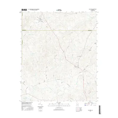
2017 Map of Culloden
USGS Topo · Published 2017About this map
Culloden sits at the intersection of several historic routes in the northern reaches of Georgia’s piedmont, where the boundaries of Monroe Co and Crawford Co meet. The settlement pattern here is deeply personal, marked by a high density of small family burial grounds such as the James R Jones Family Cem and the McNiece Family Cem, reflecting a landscape of established family farms rather than centralized urban growth. The area around Musella and south toward Uleohatchie Cr is defined by a network of local roads like W Hopewell Rd and Old Hwy 341, which follow the natural contours of the drainage basins for Walnut Cr and Echeconnee Cr. This 2017 survey details the enduring agrarian character of the region, where legacy ponds like Haygood Pond and Fincher Lake continue to anchor the rural terrain.
Find a feature on this map
61 named features on this map. Tap any name to fly to it.
Don’t see what you’re looking for? This feature index may not catch every label — zoom into the map to look around manually.
Map Details
Editions of this 2017 Culloden Map
This is the sole edition of this map. No revisions or reprints were ever made.
Other maps of this area

1951 · Yatesville
USGS Topo · 1:62,500

1955 · Phenix City
USGS Topo · 1:250,000

1956 · Fort Valley
USGS Topo · 1:62,500

1956 · Bolingbroke
USGS Topo · 1:62,500

1957 · Phenix City
USGS Topo · 1:250,000

1957 · Macon
USGS Topo · 1:250,000

1958 · Macon
USGS Topo · 1:250,000

1958 · Phenix City
USGS Topo · 1:250,000

1964 · Macon
USGS Topo · 1:250,000

1971 · Fickling Mill
USGS Topo · 1:24,000