
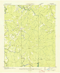
1935 Map of Cullowhee
USGS Topo · Published 1935About this map
The Tuckasegee River carves a winding path through the Jackson County highlands in this 1935 survey, defining the industrial and educational heart of the region. At the center of the map, Western Carolina Teachers College sits near the river's bend, established as the academic anchor for the growing community of Cullowhee. This era captures a landscape transitioning into a more connected mountain economy, as State Hy No 10 and State Highway No 106 parallel the riverbanks, linking the county seat at Sylva with outlying settlements like East Laport and Speedwell.
Find a feature on this map
59 named features on this map. Tap any name to fly to it.
Don’t see what you’re looking for? This feature index may not catch every label — zoom into the map to look around manually.
Map Details
Editions of this 1935 Cullowhee Map
This is the sole edition of this map. No revisions or reprints were ever made.
Other maps of this area

1891 · Cowee
USGS Topo · 1:125,000

1897 · Cowee
USGS Topo · 1:125,000

1907 · Cowee
USGS Topo · 1:125,000

1933 · Bryson
USGS Topo · 1:62,500

1935 · Tuckaseigee
USGS Topo · 1:24,000

1935 · Hazelwood
USGS Topo · 1:24,000

1935 · Addie
USGS Topo · 1:24,000

1935 · Glenville
USGS Topo · 1:24,000

1935 · Corbin Knob
USGS Topo · 1:24,000
1935 · Big Ridge
USGS Topo · 1:24,000