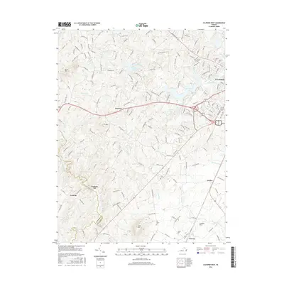
2016 Map of Culpeper West
USGS Topo · Published 2016About this map
Lake Pelham and Mountain Run Lake dominate the northern landscape of this Virginia Piedmont region, situated just west of the expanding reach of Culpeper. The terrain is defined by the prominent heights of Bruce Mtn and Fox Mtn, which overlook a network of smaller agricultural settlements. This mid-2010s survey illustrates a rural landscape transitioning toward residential development, yet it retains significant historical markers such as Waylands Mill and Fordsville. A dense network of local roads like Sperryville Pike and Wayland Rd connects scattered farmsteads and old communities. Several rural burial grounds, including All Saints Cem and Pilgrim Cem, are preserved across the countryside. To the south, the boundary between Madison Co and Culpeper Co follows the course of White Oak Run, while the southern reaches feature the distinct rises of Cedar Mtn near the village of Mitchells.
Find a feature on this map
171 named features on this map. Tap any name to fly to it.
Don’t see what you’re looking for? This feature index may not catch every label — zoom into the map to look around manually.
Map Details
Editions of this 2016 Culpeper West Map
This is the sole edition of this map. No revisions or reprints were ever made.
Other maps of this area

1887 · Spottsylvania
USGS Topo · 1:125,000

1892 · Spottsylvania
USGS Topo · 1:125,000

1892 · Gordonsville
USGS Topo · 1:125,000

1893 · Luray
USGS Topo · 1:125,000

1894 · Warrenton
USGS Topo · 1:125,000

1894 · Warrenton
USGS Topo · 1:62,500

1905 · Luray
USGS Topo · 1:125,000

1927 · Remington
USGS Topo · 1:48,000

1930 · Warrenton
USGS Topo · 1:62,500

1943 · Culpeper
USGS Topo · 1:24,000