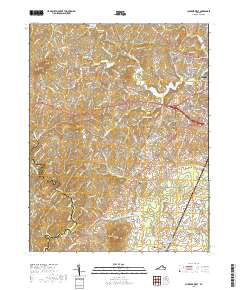
2019 Map of Culpeper West
USGS Topo · Published 2019About this map
Culpeper stands at the eastern edge of this Piedmont landscape, where the town's expanding street grid meets the rolling topography of the Culpeper Basin. The terrain is defined by a series of prominent rises including Bruce Mtn, Fox Mtn, and Cedar Mtn, which overlook a network of waterways such as Mountain Run and Cedar Run. The settlement pattern reflects deep roots in the region's agricultural and milling history, centered on rural hubs like Waylands Mill, Fordsville, and Merrimac.
Find a feature on this map
177 named features on this map. Tap any name to fly to it.
Don’t see what you’re looking for? This feature index may not catch every label — zoom into the map to look around manually.
Map Details
Editions of this 2019 Culpeper West Map
This is the sole edition of this map. No revisions or reprints were ever made.
Other maps of this area

1887 · Spottsylvania
USGS Topo · 1:125,000

1892 · Spottsylvania
USGS Topo · 1:125,000

1892 · Gordonsville
USGS Topo · 1:125,000

1893 · Luray
USGS Topo · 1:125,000

1894 · Warrenton
USGS Topo · 1:125,000

1894 · Warrenton
USGS Topo · 1:62,500

1905 · Luray
USGS Topo · 1:125,000

1927 · Remington
USGS Topo · 1:48,000

1930 · Warrenton
USGS Topo · 1:62,500

1943 · Culpeper
USGS Topo · 1:24,000