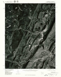
1977 Map of Cumberland
USGS Topo · Published 1979About this map
Cumberland sits at the base of the Appalachian front, where the narrow passage of Wills Branch cuts through the ridges of the Cumberland Narrows. This 1977 orthophotoquad captures the city and its surrounding satellite communities during a period of transition in western Maryland. The aerial imagery reveals the dense residential patterns that climb the hillsides and the industrial corridors that follow the water gaps. To the north, Ellerslie and Corriganville line the valley floors, while Mount Savage and Barrelville are positioned along the winding course of Jennings Run. The dramatic rise of Little Allegheny Mountain dominates the western skyline, showing the stark contrast between the wooded heights and the developed valley floor. These photo-based maps provide a clear view of land use and forest cover that traditional topographic lines often obscure, documenting the footprint of settlements like Vale before late-century changes.
Find a feature on this map
9 named features on this map. Tap any name to fly to it.
Don’t see what you’re looking for? This feature index may not catch every label — zoom into the map to look around manually.
Map Details
Editions of this 1977 Cumberland Map
This is the sole edition of this map. No revisions or reprints were ever made.
Other maps of this area

1898 · Frostburg
USGS Topo · 1:62,500

1899 · Flintstone
USGS Topo · 1:62,500

1900 · Flintstone
USGS Topo · 1:62,500

1901 · Frostburg
USGS Topo · 1:62,500

1908 · Frostburg
USGS Topo · 1:62,500

1923 · Berlin
USGS Topo · 1:48,000

1927 · Hyndman
USGS Topo · 1:62,500

1929 · Berlin
USGS Topo · 1:62,500

1931 · Hyndman
USGS Topo · 1:62,500

1944 · Hyndman
USGS Topo · 1:62,500