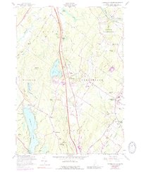
1957 Map of Cumberland Center
USGS Topo · Published 1989About this map
Highland Lake and Forest Lake anchor the western edge of this coastal Maine landscape, where the mid-century transition from traditional agriculture to a commuter-linked community is evident. The Maine Turnpike (Toll Road) cuts a modern path north-to-south through the center, contrasting with the established village cores at Cumberland Center and North Yarmouth. Educational and civic roots are anchored by the Greely Institute and Sweetser Sch, while local social life is suggested by the Cumberland Farmers Club Cem. The terrain is defined by a series of prominent rises including Blackstrap Hill and Atherton Hill, the latter of which features the Atherton Hill Lookout Tower. To the east, the Royal River and Piscataqua River drain toward the Atlantic, while the Cumberland Center Station and an Old Railroad Grade trace the legacy of earlier transportation networks.
Find a feature on this map
67 named features on this map. Tap any name to fly to it.
Don’t see what you’re looking for? This feature index may not catch every label — zoom into the map to look around manually.
Map Details
Editions of this 1957 Cumberland Center Map
4 editions found
Other maps of this area

1891 · Portland
USGS Topo · 1:62,500

1892 · Freeport
USGS Topo · 1:62,500

1893 · Portland
USGS Topo · 1:62,500

1893 · Casco Bay
USGS Topo · 1:62,500

1894 · Gray
USGS Topo · 1:62,500

1898 · Gray
USGS Topo · 1:62,500

1914 · Portland
USGS Topo · 1:48,000

1914 · Casco Bay
USGS Topo · 1:48,000

1916 · Portland
USGS Topo · 1:62,500

1916 · Casco Bay
USGS Topo · 1:62,500