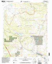
2001 Map of Cumbres
USGS Topo · Published 2005About this map
Cumbres Pass serves as the high-altitude focal point of this terrain, where the narrow-gauge Cumbres and Toltec Scenic Railroad winds through the high country of the Rio Grande National Forest. The map documents a rugged landscape defined by the intersection of the San Juan Wilderness and the historic Tierra Amarilla Grant. Settlement patterns are sparse and seasonal, represented by the La Manga Summer Home Group and small stations like Osier and Cumbres. A functional mountain infrastructure is visible through features like the Snow Shed near the pass and the Trujillo Meadows Reservoir. Numerous high-country lakes, including Red Lake and Duck Lake, dot the area north of Neff Mountain, while the Continental Divide National Scenic Trail traverses the western ridges, marking the literal backbone of the continent.
Find a feature on this map
38 named features on this map. Tap any name to fly to it.
Don’t see what you’re looking for? This feature index may not catch every label — zoom into the map to look around manually.
Map Details
Editions of this 2001 Cumbres Map
This is the sole edition of this map. No revisions or reprints were ever made.
Other maps of this area

1913 · Summitville
USGS Topo · 1:125,000

1915 · Summitville
USGS Topo · 1:125,000

1918 · Tusas
USGS Topo · 1:125,000

1922 · Conejos
USGS Topo · 1:125,000

1945 · Durango
USGS Topo · 1:250,000

1953 · Durango
USGS Topo · 1:250,000

1954 · Durango
USGS Topo · 1:250,000

1954 · Aztec
USGS Topo · 1:250,000

1955 · Chama
USGS Topo · 1:62,500

1955 · Brazos Peak
USGS Topo · 1:62,500