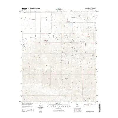
2015 Map of Cummings Mountain
USGS Topo · Published 2015About this map
Tehachapi serves as the gateway to the high-altitude landscape of the Tehachapi Mountains, where the modern road network of Ca-202 and Highline Rd intersects the geographic transition between the Tehachapi Valley and Brite Valley. The terrain is dominated by the massive profile of Cummings Mtn, which towers over a series of deep drainages including White Cow Canyon, Cedar Canyon, and the headwaters of Tejon Cr. These features illustrate the complex topography that has long influenced settlement and travel through this part of Kern County.
Find a feature on this map
90 named features on this map. Tap any name to fly to it.
Don’t see what you’re looking for? This feature index may not catch every label — zoom into the map to look around manually.
Map Details
Editions of this 2015 Cummings Mountain Map
This is the sole edition of this map. No revisions or reprints were ever made.
Other maps of this area

1903 · Tejon
USGS Topo · 1:125,000

1914 · Caliente
USGS Topo · 1:125,000

1915 · Elizabeth Lake
USGS Topo · 1:125,000

1915 · Mojave
USGS Topo · 1:125,000

1917 · Elizabeth Lake
USGS Topo · 1:125,000

1930 · Bear Mountain
USGS Topo · 1:31,680

1933 · Bear Mountain
USGS Topo · 1:31,680

1943 · Tehachapi
USGS Topo · 1:62,500

1943 · Cummings Mountain
USGS Topo · 1:62,500

1943 · Neenach
USGS Topo · 1:62,500