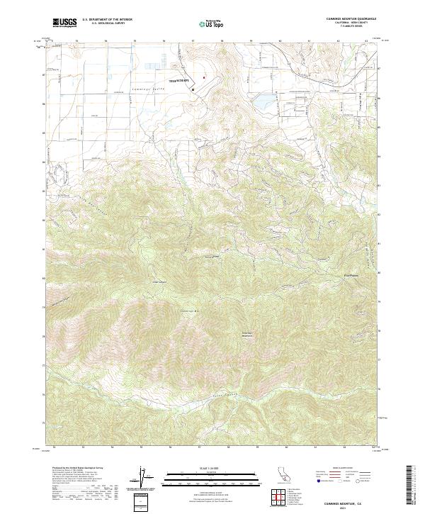
2021 Map of Cummings Mountain
USGS Topo · Published 2021About this map
Cummings Valley and the southern extent of Tehachapi dominate this section of Kern County, where the high desert transitions into the Tehachapi Mountains. The terrain is defined by steep elevation changes, rising from the residential streets of the valley floor to the prominent peak of Cummings Mtn. Water drainage patterns are clearly visible through Water Canyon and Tejon Canyon, which carry seasonal runoff toward the south and west.
Find a feature on this map
94 named features on this map. Tap any name to fly to it.
Don’t see what you’re looking for? This feature index may not catch every label — zoom into the map to look around manually.
Map Details
Editions of this 2021 Cummings Mountain Map
This is the sole edition of this map. No revisions or reprints were ever made.
Other maps of this area

1903 · Tejon
USGS Topo · 1:125,000

1914 · Caliente
USGS Topo · 1:125,000

1915 · Elizabeth Lake
USGS Topo · 1:125,000

1915 · Mojave
USGS Topo · 1:125,000

1917 · Elizabeth Lake
USGS Topo · 1:125,000

1930 · Bear Mountain
USGS Topo · 1:31,680

1933 · Bear Mountain
USGS Topo · 1:31,680

1943 · Tehachapi
USGS Topo · 1:62,500

1943 · Cummings Mountain
USGS Topo · 1:62,500

1943 · Neenach
USGS Topo · 1:62,500