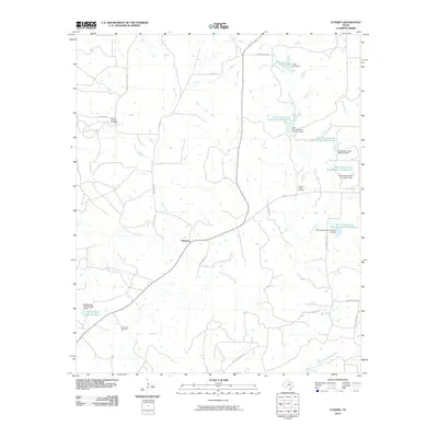
2010 Map of Cundiff
USGS Topo · Published 2010About this map
Maryetta serves as a focal point in this portion of Jack County, where the landscape is defined by the winding course of the West Fork Trinity River and its numerous tributaries. The geography is characterized by a sophisticated water management system, evident in the string of Soil Conservation Service reservoirs such as Soil Conservation Service Site 12 Reservoir and Soil Conservation Service Site 6 Reservoir that dot the drainage basins of Howard Creek and Briar Branch. For those tracing local history or family lineage, the presence of several well-established burial grounds, including Burton Springs Cemetery, Lost Creek Cemetery, and Howard Valley Cemetery, offers specific points of interest. The map also highlights significant local infrastructure like Worthington Lake Number 1 and its associated dam, alongside a network of ranch roads including Coca Cola Ranch Rd and Durham Ranch Rd, reflecting the area's rural and agricultural character.
Find a feature on this map
34 named features on this map. Tap any name to fly to it.
Don’t see what you’re looking for? This feature index may not catch every label — zoom into the map to look around manually.
Map Details
Editions of this 2010 Cundiff Map
This is the sole edition of this map. No revisions or reprints were ever made.
Other maps of this area

1954 · Sherman
USGS Topo · 1:250,000

1954 · Wichita Falls
USGS Topo · 1:250,000

1958 · Wichita Falls
USGS Topo · 1:250,000

1958 · Sherman
USGS Topo · 1:250,000

1960 · Wizard Wells
USGS Topo · 1:24,000

1960 · Jacksboro
USGS Topo · 1:24,000

1961 · Selma
USGS Topo · 1:24,000

1961 · Jacksboro NE
USGS Topo · 1:24,000

1961 · Crafton
USGS Topo · 1:24,000

1964 · Cundiff
USGS Topo · 1:24,000