
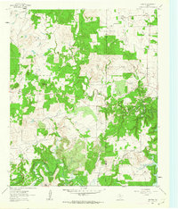
1961 Map of Crafton
USGS Topo · Published 1963About this map
Crafton and Cundiff anchor this early 1960s survey of the rolling borderlands between Jack and Wise counties. The landscape is defined by the winding course of the West Fork Trinity River, which flows into the northern reaches of Lake Bridgeport. This era shows a rural Texas economy transitioning through the development of petroleum and water resources, evidenced by scattered Oil Wells and a Pumping Sta near the riverbanks. Local history is preserved in family landmarks like the Thomas Norwood Cem and prominent terrain features such as Bear Knob. The drainage network is particularly dense, with Big Cottonwood Creek, Elm Creek, and Pecan Branch carving through the territory. These waterways and the network of unimproved roads provide a detailed view of the rural settlement patterns before significant modern expansion altered the character of the river valley.
Find a feature on this map
19 named features on this map. Tap any name to fly to it.
Don’t see what you’re looking for? This feature index may not catch every label — zoom into the map to look around manually.
Map Details
Editions of this 1961 Crafton Map
2 editions found
Other maps of this area

1954 · Sherman
USGS Topo · 1:250,000

1954 · Wichita Falls
USGS Topo · 1:250,000

1958 · Wichita Falls
USGS Topo · 1:250,000

1958 · Sherman
USGS Topo · 1:250,000

1960 · Bridgeport West
USGS Topo · 1:24,000

1960 · Wizard Wells
USGS Topo · 1:24,000

1961 · Selma
USGS Topo · 1:24,000

1961 · Jacksboro NE
USGS Topo · 1:24,000

1961 · Sunset
USGS Topo · 1:24,000
1961 · Chico
USGS Topo · 1:24,000